Scotland's Marine Atlas: Information for The National Marine Plan
Scotland's Marine Atlas is an assessment of the condition of Scotland's seas, based on scientific evidence from data and analysis and supported by expert judgement.
OVERALL ASSESSMENT
Scotland's vision is for 'clean, healthy, safe, productive, biologically diverse marine and coastal environments, managed to meet the long term needs of nature and people'
INTRODUCTION
Scotland's vision is for 'clean, healthy, safe, productive, biologically diverse marine and coastal environments, managed to meet the long term needs of nature and people'. This assessment of the condition of Scotland's seas has been based on scientific evidence from data and analysis, supported by expert judgement.
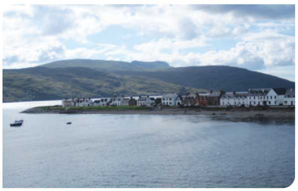
© Naomi Moffat

© Brent Harrald
Ocean Processes
Components |
State in Scottish Seas |
|---|---|
Sea temperature |
Sea surface temperature is increasing. The rate of increase over the period 1985 - 2009 has been generally greater than 0.2°C per decade. |
Sea level |
The average long-term UK trend in mean sea level is estimated as 1.4 mm/year. However the rise is not steady. For example, in the 1990s sea level rose by 3 to 4 mm per year. Rising sea levels adversely affect the low-lying parts of the coast which are vulnerable to flooding and erosion. |
Ocean acidification |
Since the industrial revolution, the CO 2 absorbed by the oceans has resulted in a decrease in pH of 0.1 units but there are currently no baseline measurements of ocean acidity against which changes in Scottish and wider UK waters can be judged. |
Circulation, suspended |
These processes vary on timescales from a day to years but have shown particulate matter, no significant trend over the past decade, except for a slight increase in turbidity, salinity, waves the salinity in the northern parts of Scottish seas. |
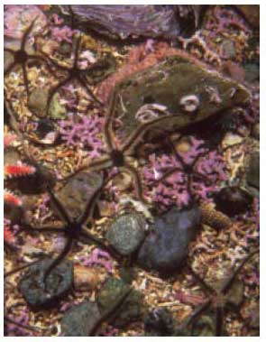
© Sue Scott
Climate Change and Ocean Acidification
The climate shows considerable variation over short and long timescales. However, in recent years there has been a marked increase in the concentration of carbon dioxide (CO 2) in the atmosphere of the Earth and, at the same time, sea surface temperature has risen as have sea levels. Changes in the biological components of the seas have been observed including earlier plankton blooms, a northward movement of some species and a reduction in seabird populations, all of which have been linked to climate change.
At the same time, the seas are becoming more acidic, the consequences of which, especially for calcareous organisms, could be significant. Reductions in the emissions of greenhouse gases are required and Scotland has set ambitious targets. However, even with such reductions, it is highly likely that further impacts of climate change on the marine environment will be observed.
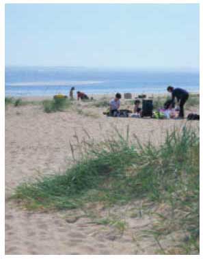
© SEPA
Clean and Safe
Scotland's seas are mainly clean and safe, although there are some localised areas where there is contamination or hazards to human health. For example, sediments in several harbours and estuaries remain contaminated with hazardous substances, a legacy of past industrial discharges. Water quality in the Forth and Clyde estuaries is compromised by discharges of industrial effluent and treated sewage although effluent treatment has improved resulting in returning populations of residential and migratory fish. The use of historical contaminants such as polychlorinated biphenyls ( PCBs) and tributyl tin ( TBT) has been banned, and monitoring continues to assess their continued environmental decline.
Information is being gathered on a range of other contaminants, including endocrine disrupters and brominated flame retardants, to assess their environmental impacts. Diffuse inputs of nutrients and bacteria have given rise, respectively, to some localised issues in small east coast estuaries and at bathing beaches. Action plans have been put in place to tackle these issues. Concerns such as marine litter and underwater noise have become more broadly recognised and will be addressed through the operational response to the Marine Strategy Framework Directive. Generally the effects of noise remain unquantified and unknown.
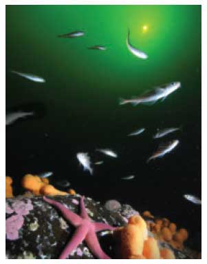
© Sue Scott
Healthy and Biologically Diverse
Scotland's seas support a diverse array of habitats and species and contain nationally and internationally important populations of certain species such as the northern feather star, the burrowing sea anemone, the northern sea fan and cold water corals.
There is evidence that certain habitats have been impacted, for example shallow and shelf subtidal sediments (including burrowed mud habitats). This stems largely from the effects of fishing over large areas of the seabed and more localised impacts from activities such as aquaculture.
The low abundance of some demersal commercial fish species across the west coast of Scotland is a major concern and is being addressed through various initiatives. Improved knowledge of fishing activity and its impact on the marine environment would be beneficial.
Establishment of new fisheries should only be undertaken following careful assessment of the viability and future sustainability of the fishery, especially given the sensitivity of some, particularly deep water, species to fishing and against a background of historic over-exploitation.
Sharks, skates and rays face further declines and are severely depleted all around the coast, although the number of sightings of basking sharks has increased in recent years especially in the Minches and Malin Sea. These declines are largely the consequence of historically unsustainable catches in both target and non-target fisheries and their long-lived, very low fecundity life cycle. Many of these, for example, porbeagle and common skate, can no longer be targeted commercially.
Populations of some seabirds, harbour seals and some fish species have declined. Possible reasons include climate change, a number of different human activities and competition from other species. These declines may be associated with broader changes in the food web. For example, the decline in availability of sandeels has had a major influence on recent changes in seabird numbers on the east coast and in the Northern Isles.
Although, in general, the current assessment for cetaceans suggests there are no specific concerns, this has been made against a background of a very high level of uncertainty and little power to detect concerns if they currently exist.
© John M. Baxter
Productive
Scotland's seas are economically productive. Official figures show that the core marine sector, less the extraction of oil and gas, contributed £3.6 billion of Gross Value Added ( GVA) in 2008 (at 2009 prices), about 3.5% of overall Scottish GVA. About 39,800 people were employed, 1.6% of Scottish employment. The extraction of oil and gas had a GVA of £13.3 billion in 2007 (at 2009 prices).
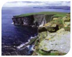
Fishing takes place in all Scottish sea areas but some, such as Hebrides, North Scotland Coast and East and West Shetland, are far more economically productive than others. Aquaculture, both finfish and shellfish, predominates on the west coast and the islands.
Sixteen major ports handle about 98% of all port traffic with liquid bulk, mainly oil and gas, accounting for 69%. There is significant commercial shipping both to ports and for transit through Scottish waters, as well as domestic and international ferry activity. The seas are also used extensively by the Royal Navy and other armed forces, for exercises and operations, sometimes including international partners.
Other activities include cooling water abstraction for power stations and the disposal of treated urban waste water, industrial effluent and dredge spoil. Seabed telecommunications cables carry millions of internet and phone call connections, thereby providing a major communications network.
The seas are also used for leisure and recreation, particularly sailing, angling and other sporting activities. Scotland's historic environment and natural and cultural heritage attract many tourists.
The enormous potential of marine renewable energy generation from offshore wind, waves and tides has started to be harnessed. There is also potential for storage of carbon dioxide under the seabed, in 'carbon capture and storage' schemes.
Pressures
In this assessment, a pressure is a human activity which could lead to an impact, i.e. a change in the condition or state of an ecosystem component. Scotland's extensive marine area is subject to a wide range of pressures. While recognising that there may be cumulative effects, a large number of these individual pressures are at too small a scale to be considered significant at the national level of this assessment. However, some may have local impacts that could threaten rarer species and habitats.
In the 'Activities and Pressures' sections of the following summaries, the aim is to demonstrate both the economic importance of the sea area (through percentages to show how much of the total of that activity in Scottish waters is in that area) as well as to identify pressures and trends. A large amount of activity does not necessarily result in significant pressure on ecosystem components especially where such activities are effectively managed. Conversely, a small amount of activity could result in a significant pressure to a specific ecosystem component if not well managed. Significant pressures have been highlighted separately.
There are two significant pressures on the Scottish marine area which are widespread:
- Human activity contributing to climate change
- Fishing, which impacts on the seabed and species
Fishing is a complex activity. There are various types, each of which exerts a different pressure on the marine environment. Bottom trawlers and scallop dredgers drag their gear across the seabed so potentially damaging it. Pelagic trawlers and long liners fish in the water column, and their gear does not normally touch the seabed. Static nets, pots and creels are lowered onto the seabed and recovered later, although they can drag and damage fragile habitats and species. All types of fishing, of course, remove fish from the sea. As Vessel Monitoring System ( VMS) terminals are not compulsory on vessels below 15 m, there are less spatial data available about the activities of this part of the fleet which represents a data gap.
Pressures which are becoming more widely recognised include noise pollution and marine litter. However, the impacts of noise and the longer term effects of the microparticles arising from the breakdown of litter are not well understood. Some pressures may change in scale and location in the future. For example, those associated with offshore oil and gas as new oil and gas fields are discovered and old ones are decommissioned. Also, aquaculture may move offshore to less sheltered waters as technology develops.
New pressures are likely to include those associated with the storage of carbon dioxide deep under the seabed and renewable energy, including offshore wind, wave and tidal power. In particular, further work is required to determine the potential impacts of renewable energy, such as the general effects on shipping, fishing and biodiversity. Possible local concerns beyond these are identified in each summary.
Response
Actions are in place to mitigate the effects of many of the pressures on the marine environment. These actions include education, awareness raising and government activity, such as regulation, licensing, monitoring, management and scientific research.
Marine monitoring programmes assess current status and trends and the effectiveness of mitigation measures, such as pollution control. These programmes also serve to identify gaps in knowledge.
This Atlas is the key science evidence base for the first Scottish national marine plan. The Marine (Scotland) Act 2010 and the Marine and Coastal Access Act 2009 set the statutory basis for national marine planning in Scottish waters out to 200 nautical miles, and for regional planning potentially out to 12 nautical miles. The marine planning process allows for participation by a wide range of interests in expressing policies for sustainable development - promoting sustainable economic growth which takes account of environmental issues and limits and social and cultural perspectives. The development of marine plans will therefore be an important new method of ensuring opportunities and concerns are identified and action is taken to exploit opportunities and address concerns.
Under the Marine Strategy Framework Directive ( MSFD) there is an obligation to take the necessary measures to achieve and maintain Good Environmental Status ( GES) for marine waters by 2020. A programme of measures is to be implemented by 2016, which will comprise feasible responses needed to meet the requirements of the Directive. Details of the MSFDGES descriptors are presented in Chapter 1.
CLEAN AND SAFE SEAS ASSESSMENT
HEALTHY AND BIOLOGICALLY DIVERSE SEAS - HABITATS ASSESSMENT
HEALTHY AND BIOLOGICALLY DIVERSE SEAS - SPECIES ASSESSMENT
PRODUCTIVE SEAS ASSESSMENT

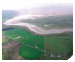
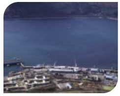
SOLWAY FIRTH, NORTH CHANNEL AND CLYDE
Characteristics
These two sea areas extend from the English border in the Solway Firth to the upper reaches of the Clyde Estuary in Glasgow and to the Mull of Kintyre. They include the Solway Firth, North Channel and the Clyde, which itself includes the Clyde Estuary, the Firth of Clyde and the Clyde sea lochs. In general the waters are relatively shallow but reach depths of over 100 m in the fjordic sea lochs of the Clyde and in excess of 250 m in Beaufort's Dyke. The areas exhibit a considerable tidal range, illustrated by mesotides (2-4 m) in the Clyde area and macrotides (more than 4 m) in the Solway Firth.
Natural features include large intertidal mudflats and sandflats in the Solway Firth and Clyde Estuary. The areas are important for wintering wildfowl and waders and have extensive mussel beds.
Activities and Pressures
The areas host a wide range of human activities and consequently are subject to a number of pressures.
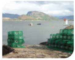
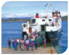
Aquaculture, particularly salmon and shellfish production, takes place in a number of sea lochs and there is widespread fishing, mainly for Nephrops and scallops. There are significant ports, shipping and ferry activities with 20% of Scottish cargo volume passing through the Clyde ports. These are the busiest areas for ferry traffic with key links to various islands and peninsulas, as well as Northern Ireland, accounting for 64% of overall Scottish passenger traffic. Scotland's only Naval base is on the Clyde. The areas are popular for recreational sailing, supporting 44% of Scottish boat berths. There are also popular bathing beaches on the Ayrshire coast.
The Clyde Estuary and Ayrshire coast are relatively urbanised and industrialised compared with other parts of Scotland. This results in discharges from waste water treatment works and industrial effluents to estuary and coastal waters, as well as water abstraction, mainly for power generation. There are seabed telecommunication cables and power cables to Ireland and Northern Ireland and the Robin Rigg wind farm in the Solway Firth.
Pressures resulting from these activities include the introduction of contaminants from industrial effluents and sewage works and dumping of dredge spoil from harbour maintenance. Fishing using trawls and dredges results in the abrasion of the seabed. There are also local effects of aquaculture on seabed ecology.
Recreational boating and commercial shipping activities have probably led to the introduction of non-native species.
Caerlaverock
|
HMNBClyde
|
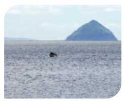
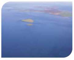
Ailsa Craig
|
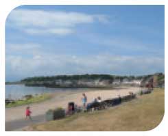
Millport bathing beach
|
Queen Mary 2 at Greenock
|
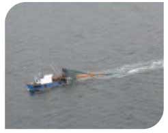
Trawler in the Clyde
|

Condition
Clean and Safe
At the area level there are few concerns in relation to hazardous substances, radioactivity, oil and chemical spills and algal toxins. Contaminant loadings to the Clyde Estuary are lower now compared to historical discharges but a legacy of localised contaminated sediments remains. These in turn have caused elevated concentrations of contaminants in mussels in the Clyde Estuary.
Water quality in the Clyde estuary is compromised by discharges of industrial effluent and treated sewage although effluent treatment has improved resulting in returning populations of residential and migratory fish.
The quality of bathing and shellfish waters in the Firth of Clyde is affected by inputs of bacteria from diffuse sources, which increase during periods of high rainfall. Local accumulations of litter are observed on some beaches possibly being transported by the prevailing currents. The source is not always possible to identify.
Healthy and Biologically Diverse
The status of habitats within the areas is mixed. Intertidal habitats (rock and sediments) are deteriorating. In relation to rocky intertidal habitats this is due to invasion of non-native species, in particular wireweed. Shallow subtidal sediments are relatively degraded while shallow, subtidal rocky habitats appear to be in a better state. In general, mobile species such as cetaceans, seals and seabirds also show a mixed picture
but overall are stable at the area level. In contrast, the reduced populations of commercial fish are a major concern. The introduction and establishment of a number of invasive non-native species, for example, intertidal wireweed ( Sargassum muticum) and the subtidal carpet sea squirt ( Didemnum vexillum), first found at Largs in 2009, is very concerning.
Response/Forward Look
Many of the concerns associated with these areas result from historical practices and management approaches. Enhanced scientific knowledge, improved regulation and greater environmental awareness have resulted in significant reductions in inputs of contaminants and improvements in water quality.
Pressure on coastal and inshore habitats is increasing from industry such as the proposed Hunterston power station (with a possible change in cooling water requirements), aquaculture and recreational activities. The areas have a significant resource to support the generation of marine renewable energy, mainly offshore wind and tidal. Growth of the industry and development of associated infrastructure, including seabed cables, is anticipated. Further work will be required to understand the effects on seascapes and landscapes, communities, tourism and recreation.
Increasing shipping activity, possible new container facilities at Hunterston, and recreational sailing will risk the further introduction of non-native species. Underwater noise associated with industrial and recreational activities is expected to increase. There is also the possibility of increased ferry traffic to Northern Ireland with facilities in Loch Ryan due to expand.
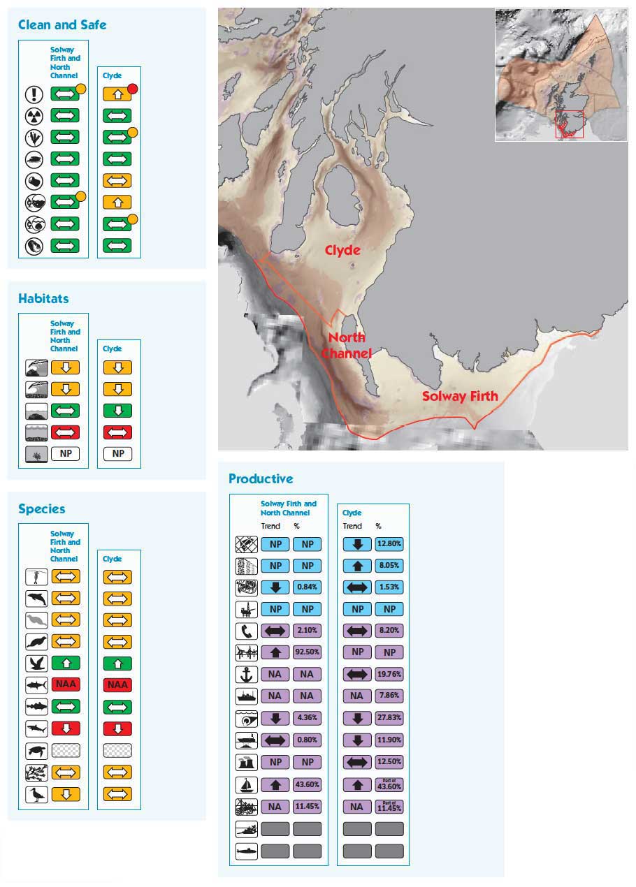
Solway Firth and North Channel
Surface area 3,923 km 2
Maximum depth 265 m
Minimum depth 0 m
Average depth 55 m
Clyde
Surface area 4,092 km 2
Maximum depth 151 m
Minimum depth 0 m
Average depth 40 m
Area based on high water mark Albers Equal Area Projection. Depths based on 1 arc-minute ETOPO bathymetry. (1)
MINCHES AND MALIN SEA
Characteristics
The area extends north from the Mull of Kintyre to Cape Wrath incorporating the sea area between the Scottish mainland and the Western Isles. The seabed is coarse sands, gravel and rock. The coastline of the Scottish mainland is dissected by many fjordic sea lochs which are sheltered from wave action. In contrast, fjardic sea lochs such as Loch Maddy with its complex of basins, tidal rapids and lagoons, are found on the east coast of the Western Isles. Sandy bays are present in many parts of the area. One of Scotland's amphidromic points (where the tidal range is almost zero) is found off Islay.
A large range of habitats supports a great diversity of wildlife. Notable features include cold water coral reef structures near Mingulay, Firth of Lorn pockmarks (seabed craters), sea pen beds, Nephrops grounds and areas important for marine mammals and seabirds.
Activities and Pressures
The inshore bays and sea lochs are important for aquaculture (50% by value of finfish production and 34% of shellfish) along with inshore commercial fisheries for mainly Nephrops, scallops, lobster and crab, providing important support for local rural economies. There are important fishing ports such as Ullapool and Lochinver.
The various island communities are serviced by a network of ferry routes that are also important for tourism. The scenic landscape, sheltered waters and accessibility make the area attractive for recreational sailing, with around 39% (figure includes Hebrides) of all sailing boat berths in Scotland. Wildlife tourism and recreational diving are also popular.
The Minches are used as a sheltered shipping route and the Raasay Deep, near Skye, is used as an exercise area by submarines. Glensanda on Loch Linnhe is a major stone export quarry. There are a large number of power cables on the seabed carrying electricity to the islands.
Pressures on the marine area as a result of these activities include the effects of fishing (particularly from trawlers and dredgers). There are also local effects of aquaculture on seabed ecology, and localised pressure on coastal landscapes and wildlife from tourism.
Plockton
|
Ferry to Iona
|
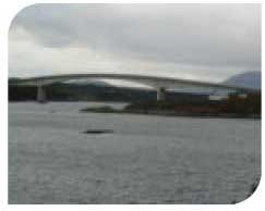
Skye Bridge
|
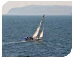
Sailing in the Minches
|
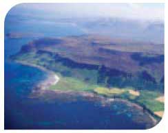
Mull
© SNH |
Fish farm, Loch Torridon
© John M. Baxter |

Condition
Clean and Safe
At the area level, there are few or no concerns for many of the components assessed (hazardous substances, radioactivity, eutrophication, oil/chemical spills, algal toxins and microbiology of bathing and shellfish waters). Concentrations of most contaminants are low in sediments and mussels. There are relatively few land based sources of contaminants, and while concentrations of copper and zinc are elevated under some fish farm cages there is no evidence of up take by local mussels.
Significant blooms of the phytoplankton species responsible for production of Amnesic Shellfish Poisoning ( ASP), Diarrhetic Shellfish Poisoning ( DSP) and Paralytic Shellfish Poisoning ( PSP) were detected in the west coast in 2009 resulting in the closure of commercial shellfish harvesting areas for DSP and PSP toxins.
Healthy and Biologically Diverse
Habitats are in relatively good condition, although there are concerns about the condition of shallow subtidal sediments impacted by trawling.
Some commercial fish species have declined considerably from levels that may be considered reasonable for a healthy ecosystem, although declines in demersal species appear to have been halted. Some seabird species have also declined. As elsewhere, most sharks and rays are in decline although there have been increased sightings of basking sharks in recent years. Plankton, cetaceans and seals are stable at the area level.
The sea lochs contain a range of important habitats and communities and include some internationally important examples such as the highly unusual serpulid worm ( Serpula vermicularis) aggregations only found in Loch Creran and Loch Teacius where they are protected.
Response/Forward Look
The area is one of the most scenic in Scotland and is home to a variety of habitats and species. Consequently, future economic expansion of marine recreation and wildlife tourism is expected and it is possible this may be accompanied by increased environmental pressures. There will be a need to protect the biological diversity and address the condition of demersal fish and shark and ray populations.
The area has a significant resource to support the generation of marine renewable energy, offshore wind, waves and tidal. Growth of the industry and development of associated infrastructure, including seabed cables, is anticipated. Further work will be required to understand the effects on seascapes, landscapes, communities, tourism, recreation and cultural heritage.
This area is also expected to remain one of the most important areas in Scotland for aquaculture which could potentially change in location and scale as technology allows it to move to more exposed waters.
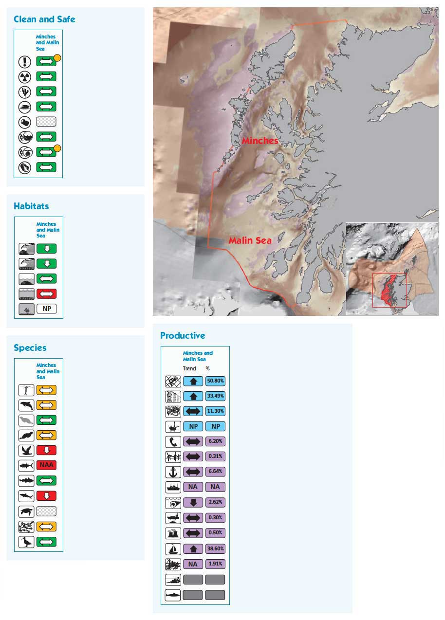
Minches and Malin Sea
Surface area 30,007 km 2
Maximum depth 307 m
Minimum depth 0 m
Average depth 64 m
Species
Area based on high water mark Albers Equal Area Projection. Depths based on 1 arc-minute ETOPO bathymetry. (1)
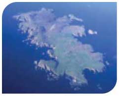
HEBRIDES
Characteristics
This area is defined by the western coast of the Western Isles and extends out to the edge of the continental shelf. The coastline is predominantly rocky and exposed but with some more sheltered sandy bays between and on islands. Deep waters lie at or just beyond the continental shelf edge bringing important ecological communities within Scottish waters, including deep water fish species and oceanic marine mammal populations.
Areas of particular interest include St Kilda, a world heritage site for its cultural and natural heritage, seabird colonies of international importance and the Monach Isles, home to the second largest grey seal colony in the world.
The clarity of the water encourages seaweeds to grow to greater depths than elsewhere around the coast. This is especially evident on some of the more offshore islands, kelp for example is found at depths in excess of 45 m around St Kilda, compared to around 5-10 m off the North Sea coast.
Activities and Pressures
The Hebrides sea area has some of the most remote rural and coastal communities in the UK. The economies of these communities often rely upon fishing (14% by value of the landed catch in Scottish seas and in excess of 10% of total employment being from the fisheries sectors in the Uists and Barra) and aquaculture (8% of Scottish shellfish production). Inshore fisheries are mainly focused upon shellfish. However, there are important fishing grounds to the west of the area, beyond St Kilda, for both demersal fish species, such as anglerfish, and for pelagic species, especially mackerel, and these are typically exploited by vessels from the Scottish east coast or from other European countries. The area is important for military exercises and deepwater shipping routes also pass through this area.
Pressures on this marine area are largely related to those from fishing by trawlers and dredgers. More is known about the pressures from the larger demersal and pelagic vessels operating mainly in deeper waters to the west and towards the continental shelf edge, and this part of the fishery is subject to closer management and scrutiny. Otherwise, this is currently one of the least pressurised areas around Scotland.
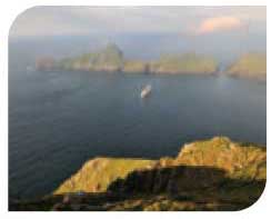
St Kilda
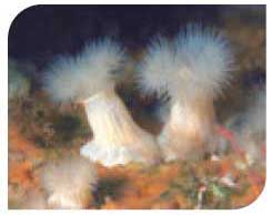
|
Plumose Anemone, St Kilda
|
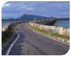
Causeway in the Uists
|
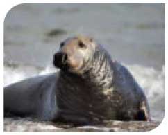
Grey seal
|
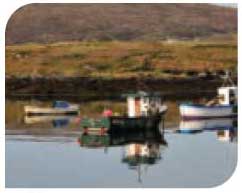
Fishing boats in the Uists
|
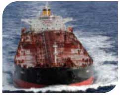
Tanker off the Outer Hebrides
|
Condition
Clean and Safe
There are no significant concerns as regards radioactivity, eutrophication, microbiological contamination, oil/ chemical spills or algal toxins. Limited information is available for the status of hazardous substances. Shellfish water quality is generally good, and there are no designated bathing waters in the area. Elevated cadmium levels have been found in some fish species from deeper waters although the origins of this are unknown and could be natural.
Healthy and Biologically Diverse
Habitats within the area are in relatively good condition overall but the effects of trawling and scallop dredging on benthic habitats and the capture of non-target species in fishing operations is a cause for some concern, especially in deep waters where restoration could take many decades or centuries.
Seabirds are showing some declines. Grey seal populations are stable with no significant concerns. Harbour seals are showing signs of decline but not as great as seen in the Northern Isles and east coast of Scotland.
Response/Forward Look
Fishing pressure from mobile demersal fishing continues to decline. Improvements to the demersal fish community have been observed but there is a lag in realising the potential benefits of the reduction of the fishing pressure on fish populations and benthos. Aquaculture will remain an important industry and could potentially change in location and scale as technology allows it to move to more exposed waters.
The area has a significant resource to support the generation of marine renewable energy, offshore wind, waves and tidal. Growth of the industry and development of associated infrastructure, including seabed cables, is anticipated. Further work will be required to understand the effects on seascapes, landscapes and cultural heritage as well as for the cetacean populations in the area.
There are undeveloped hydrocarbon reserves in the north of the area. These may be exploited as the oil price rises and new technology is developed, so bringing additional pressures to the area. Tanker traffic to the west of the Hebrides presents environmental risks with low frequency of occurrence but with the possibility of significant consequences should an accident occur.
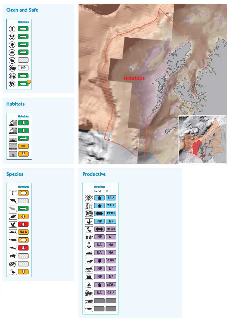
Hebrides
Surface area 41,135 km 2
Maximum depth 1,357 m
Minimum depth 0 m
Average depth 190 m
Area based on high water mark Albers Equal Area Projection. Depths based on 1 arc-minute ETOPO bathymetry. (1)
ROCKALL, BAILEY AND FAROE SHETLAND CHANNEL
Characteristics
These three sea areas incorporate much of Scotland's western and northern offshore region. They include deep water and are the only truly oceanic areas within UK seas. Deep waters remain at the frontier of marine exploration which means that knowledge of these areas is more limited than elsewhere.
These areas encompass Rockall which has negligible coastline and no soft intertidal sediments. In places deep water trenches exceed 2,000 m. The North West Rockall Bank is recognised for its geological formations and marine communities, as are other sea mounts, banks and ridges.
Activities and Pressures
The remote nature of these areas means there are few human activities and pressures relative to those in areas closer to centres of population. There are some important fishing grounds that support fisheries for both demersal and pelagic species (4% by value of the landed catch in Scottish seas in Rockall; 3% in Bailey and less than 1% in Faroe Shetland Channel), but the remoteness and water depth mean that few if any small vessels operate here.
Transatlantic shipping transits these areas although the data available do not quantify this. These sea areas have about 35% (by length) of all the active telecommunications cables within Scottish seas.
Pressures are mainly associated with trawling damage to the seabed. The installation and maintenance activity associated with telecommunications cables can cause short-term changes to the seabed sediments and possibly habitat damage.
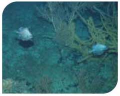
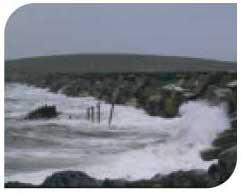
Rockall
|
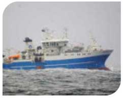
FRV Scotia
|
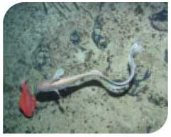
Orange roughy and roundnose grenadier
|
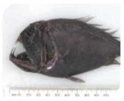
Fangtooth, deep water fish
|
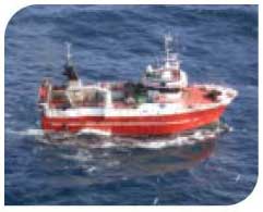
Fishing near Rockall
|
False boarfish and corals
|
Condition
Clean and Safe
Data are not available for all the parameters used to assess whether the seas are clean and safe. This is due to the remoteness of the area and the relative lack of inputs from land. Few or no concerns have been found in relation to the components assessed, which include oil/chemical spills and hazardous substances. Information on hazardous substances is limited to deep sea fish. Elevated levels of cadmium have been found which exceed the maximum dietary levels for humans. However, these fish are very unlikely to be eaten by humans and the origins of the cadmium are possibly natural. Low concentrations of both polychlorinated biphenyls and polybrominated diphenyl ethers have been detected in fish from depths of 1,500 m. Since there are no local inputs of these chemicals, the most likely source is from atmospheric deposition.
Healthy and Biologically Diverse
There are only very small amounts of intertidal and shallow subtidal rock (on Rockall itself) but these represent some of the most wave exposed habitats in the UK. Some deep sea habitats and their associated species have been impacted by trawling. Although detailed information is not available for many of the species groups, assemblages of demersal fish appear to be less diverse and smaller in size than before exploitation of this area began.
Notable features include the recently discovered cold water coral reefs on the 'Darwin Mounds' where there is evidence that deep water trawling has caused some damage to the reefs. It could take decades or centuries for these to fully recover.
The various banks and seamounts attract important fish assemblages including some species that have only recently been exploited, such as the orange roughy ( Hoplostethus atlanticus) which are already showing worrying declines in their abundance. The commercial orange roughy fishery is currently closed to EU vessels. Rockall, Bailey and Faroe Shetland Channel also host a rich diversity of cetaceans, including oceanic species which probably migrate through these waters seasonally.
Response/Forward Look
Changes in plankton populations are expected because of climate change and ocean acidification. There is some indication that ocean acidification is occurring more rapidly than further inshore and this may be having a significant effect on phytoplankton.
There are undeveloped hydrocarbon reserves on the eastern edge of Bailey as well as recently licensed exploration blocks within Faroe Shetland Channel. Increased activity of this nature presents potential environmental risks with low frequency of occurrence, but they could carry serious consequences.
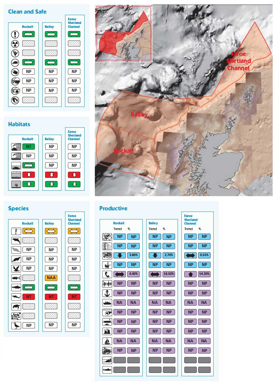
Rockall
Surface area 65, 218 km 2
Maximum depth 2,638 m
Minimum depth 0 m
Average depth 1,455 m
Bailey
Surface area 74,553 km 2
Maximum depth 2,293 m
Minimum depth 71 m
Average depth 1,360 m
Faroe Shetland Channel
Surface area 42,684 km 2
Maximum depth 2,392 m
Minimum depth 341 m
Average depth 1,275 m
Area based on high water mark Albers Equal Area Projection. Depths based on 1 arc-minute ETOPO bathymetry. (1)
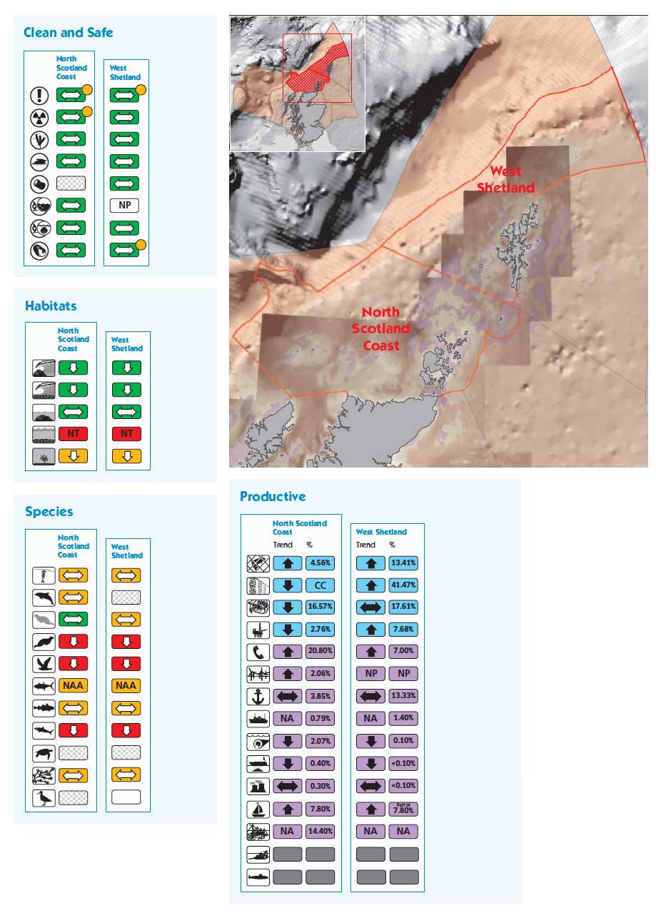
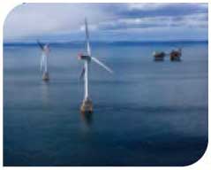
NORTH SCOTLAND COAST AND WEST SHETLAND
Characteristics
These two sea areas extend from Cape Wrath on the mainland to where the sea north-east of Shetland meets the international boundary. It includes the northern coast of the Scottish mainland as well as the rocky, wave exposed coastlines of western Shetland, Fair Isle and Orkney together with the mosaic of habitats in the northern isles of Orkney. Most of these are exposed to the full force of the Atlantic. Strong tidal currents are found in areas such as the Pentland Firth where Atlantic water exchanges with the North Sea. In contrast, there are sheltered inlets such as Yell Sound and Sullom Voe in Shetland, and Scapa Flow in Orkney, which are important both for local biodiversity and economic activity.
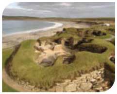
The areas have been a centre of cultural importance throughout history. This is illustrated by prehistoric settlements and modern wartime features. Submerged settlements and landscapes are becoming apparent through the application of modern surveying methodologies.
Activities and Pressures
The nature of the coastline and the water conditions around the Orkney and Shetland coasts provide ideal conditions for aquaculture: 18% by value of all Scottish finfish (mainly salmon) production and 42% of shellfish (mainly mussels) production occurs in Shetland. This is an important industry for these island communities. Commercial fishing is also important with 17% by value of total landed catch in North Scotland Coast and 18% in West Shetland.
The oil and gas industry is significant for these areas, accounting for about 10% by value of all production from Scottish seas. Europe's largest oil terminal is at Sullom Voe, West Shetland and there is a smaller terminal on Flotta, Orkney. The areas handle about 17% by volume of all Scottish cargo (mainly in the form of oil) but only 2.5% of calling ships.
Locations within the areas offer potential for renewable energy production. The European Marine Energy Centre's test sites for wave and tidal power are in Orkney, as well as the sites of the world's first commercial wave and tidal lease agreements. The natural, cultural and historic heritage of Orkney and Shetland attract large numbers of visitors and generate significant contributions to the local economy. This includes considerable diving activity at sites mainly within Scapa Flow on the WWI German Fleet. These areas, together with East Shetland, Fladen and Moray Firth, share about 8% of all Scottish recreational sailing berths; these being mainly in Orkney, Shetland and the Moray Firth.
The main pressures come from trawling damage to the seabed, local effects of aquaculture on seabed ecology and localised effects of surface oil sheens caused by oil leakage from the sunken wrecks.
Skara Brae, Orkney
|
Fair Isle
|
EMEC test site, Orkney
|
Churchill Barriers, Orkney
|
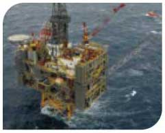
BP Clair Platform, West Shetland
|
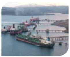
Sullom Voe terminal, Shetland
|
Condition
Clean and Safe
At an area level, there are no significant concerns for many of the parameters assessed (hazardous substances, eutrophication, radioactivity, oil/chemical spills, algal toxins and microbiology of bathing and shellfish waters). There are, however, some small localised effects, such as radioactivity near the nuclear facility at Dounreay on the north coast of the Scottish mainland, and continuous oil leakage from sunken warships in Scapa Flow. Imposex, caused by TBT from anti-fouling paints, was a concern in Sullom Voe, but these impacts have declined.
Significant blooms of the phytoplankton species responsible for production of Amnesic Shellfish Poisoning ( ASP), Diarrhetic Shellfish Poisoning ( DSP) and Paralytic Shellfish Poisoning ( PSP) were detected in Shetland in 2009 resulting in the closure of commercial shellfish harvesting areas for DSP and PSP toxins.
Healthy and Biologically Diverse
Habitats within the areas are in relatively good condition and there are no significant concerns. There are, however, concerns for some shallow subtidal sediments, mainly as a result of the impact of scallop dredging.
Breeding seabird numbers of some species have shown a long-term decline, most probably as a result of a shortage of key prey species such as sandeels associated with changes in oceanographic conditions.
Harbour seals have declined significantly in the past 10 years and this is a cause for considerable concern. In contrast, grey seals have increased in numbers over the same time. Populations of some commercially-exploited fish species are depleted, especially demersal species such as cod.
Response/Forward Look
The areas, particularly around the Pentland Firth and Orkney waters, have a significant resource to support the generation of marine renewable energy, offshore wind, waves and tidal. Growth of the industry and development of associated infrastructure, including seabed cables, is anticipated. Further work will be required to understand the effects on seascapes, landscapes and cultural heritage. This will be underpinned by a marine spatial plan pilot in these waters, which will identify priorities for development and management.
Decommissioning of offshore production facilities will be more prominent in the future. The scale and location of oil and gas exploitation in the areas may change as a result of the development of new technologies and oil price rises. While this will bring new pressures to these areas, monitoring records from Sullom Voe show that careful management can result in such development with virtually no detectable long-term marine impacts.
Aquaculture will remain an important industry and could potentially change in location and scale as technology allows it to move to more exposed waters.
Scapa Flow has been identified as a development opportunity to accommodate container traffic.
North Scotland Coast
Surface area 46,057 km 2
Maximum depth 1,066 m
Minimum depth 0 m
Average depth 155 m
West Shetland
Surface area 34,834 km 2
Maximum depth 603 m
Minimum depth 0 m
Average depth 216 m
Area based on high water mark Albers Equal Area Projection. Depths based on 1 arc-minute ETOPO bathymetry. (1)
EAST SHETLAND, FLADEN AND MORAY FIRTH
Characteristics
These three sea areas extend south from the eastern side of Shetland to the Moray Firth. They include an extensive offshore area characterised by flat sandy seabed with occasional pockmarks (seabed craters), and small inshore firths often with sandbanks, mud flats and sandy beaches. Areas of the coastline are rocky and internationally important seabird colonies are present, for example at Noss and Hermaness in Shetland and Duncansby Head on the east coast mainland.
Major inflows of Atlantic water into the North Sea through the Pentland Firth and Fair Isle Channel transport nutrients and plankton to the North Sea.
Activities and Pressures
These areas are the most economically important for oil and gas with 65% of oil and gas produced and 59% of seabed pipelines. Nineteen percent of calling ships visited ports here although only 5% of Scottish cargo was handled. In recent years the Moray Firth area has been a focus for renewable energy development, with the Beatrice Windfarm Demonstrator Project. Onshore facilities are adapting to service this growth industry. Sixteen percent of telecommunications cables are on the seabed, in these areas.
Commercial fishing is important and widespread with 14% of total landed catch by value coming from East Shetland. The Fladen Ground is also important with 9% of total catch value, especially for Nephrops. Much of the Scottish demersal and pelagic fishing fleets operate here. Aquaculture is also a prominent industry in East Shetland accounting for 16% of Scottish salmon production.
Local wildlife tourism has developed. In particular, trips in the Moray Firth to view the most northerly population of bottlenose dolphins as well as the accessible seabird colonies are especially popular. These areas, together with North Scotland Coast and West Shetland, share about 8% of all Scottish recreational sailing berths; these are mainly in Orkney, Shetland and the Moray Firth.
Pressures resulting from these activities include possible localised contamination from oil and gas activity and dumping of dredge spoil from harbour maintenance. Trawling results in the abrasion of the seabed and there are local effects of aquaculture on seabed ecology in the north of the areas. There is also localised pressure on coastal landscapes and wildlife from tourism.
Beatrice Windfarm Demonstrator
|
Noss, near Bressay, Shetland
|
Lerwick Harbour, Shetland
|
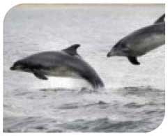
Bottlenose dolphins
|
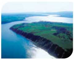
Cromarty Firth
|
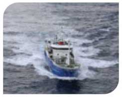
Pelagic fishing boat
|
Condition
Clean and Safe
At an area level, there are few or no concerns for many of the components assessed (hazardous substances, eutrophication, radioactivity, oil/chemical spills, algal toxins and microbiology of bathing and shellfish waters). Some concerns have been seen at a local level, for example concentrations of copper and zinc are elevated under marine caged fish farms in East Shetland, and beach litter is a concern in the Moray Firth area.
Significant blooms of the phytoplankton species responsible for production of Amnesic Shellfish Poisoning ( ASP), Diarrhetic Shellfish Poisoning ( DSP) and Paralytic Shellfish Poisoning ( PSP) were detected in Shetland in 2009 resulting in the closure of commercial shellfish harvesting areas for DSP and PSP toxins.
Healthy and Biologically Diverse
Intertidal habitats within the areas are in relatively good condition and improving. The shallow subtidal sediments in the Moray Firth are relatively impoverished as a result of demersal fishing activity.
In recent years seabird breeding success in Shetland has decreased significantly. Changes in the marine environment, affecting the availability of fish prey, such as sandeels, are thought to be primarily responsible for this. Harbour seals have declined in the areas although the decline in the Moray Firth population appears to have been arrested, whilst grey seal numbers have been increasing but there are signs that the population is now levelling off.
Response/Forward Look
The scale and location of oil and gas exploitation in the areas may change as a result of the development of new technologies and oil price rises. Decommissioning of offshore production facilities will be more prominent in the future. Development of carbon dioxide storage is expected to support carbon capture and storage.
The areas have a significant resource to support the generation of marine renewable energy, mainly offshore wind. Growth of the industry and development of associated infrastructure, including seabed cables, is anticipated. Further work will be required to understand the effects on seascapes, landscapes and cultural heritage as well as for the cetacean populations in the areas.
Fishing is likely to continue to be an important industry for the foreseeable future, although careful management will be required to ensure future sustainability against a background of historic over-exploitation. Marine recreational activities are expected to increase, a significant proportion of which will be marine wildlife tourism. Management of this growth industry will be required to minimise impacts on wildlife and habitats.
Aquaculture will remain an important industry and could potentially change in location and scale as technology allows it to move to more exposed waters.
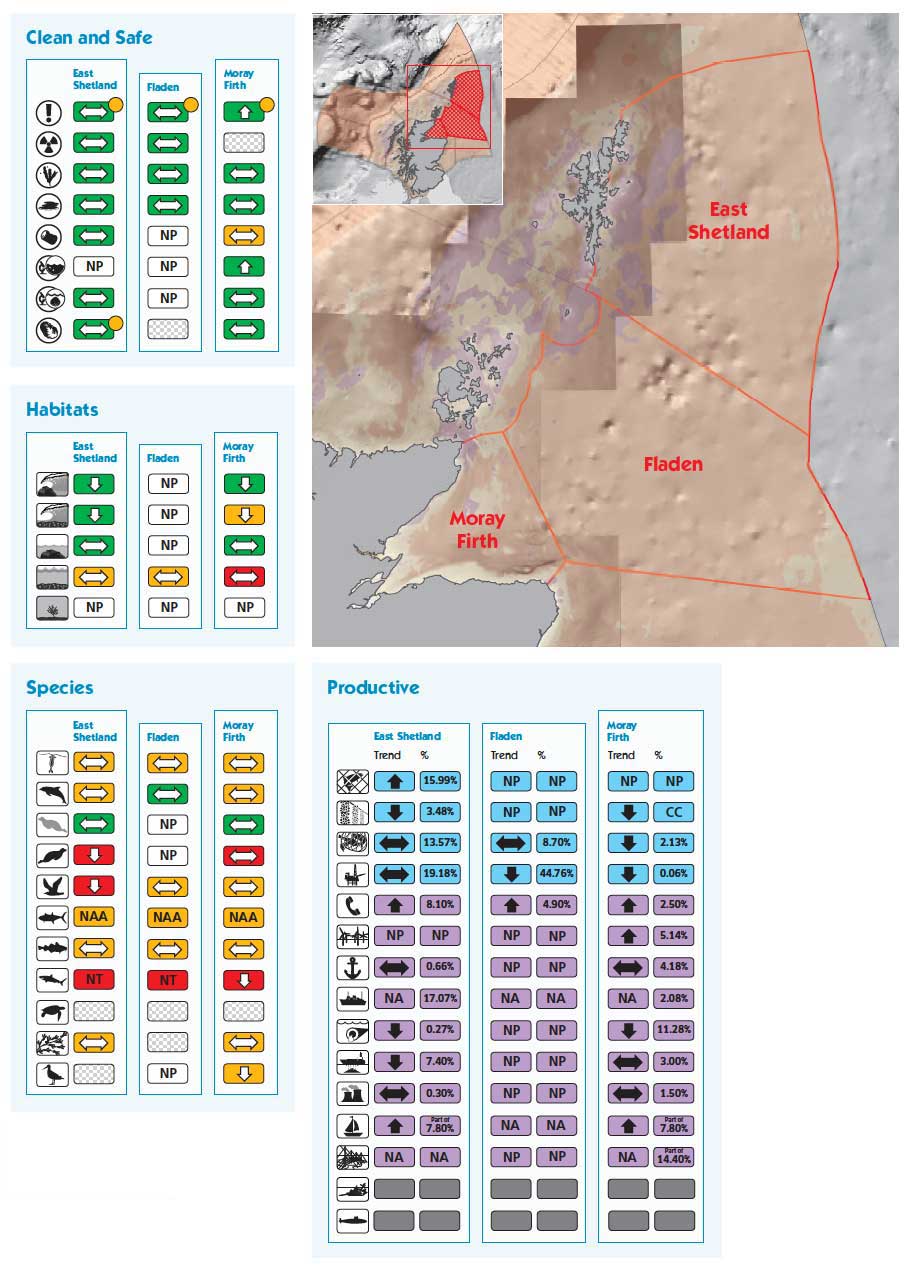
East Shetland
Surface area 37,991 km 2
Maximum depth 168 m
Minimum depth 0 m
Average depth 117 m
Fladen
Surface area 37,193 km 2
Maximum depth 231 m
Minimum depth 53 m
Average depth 114 m
Moray Firth
Surface area 10,137 km 2
Maximum depth 213 m
Minimum depth 0 m
Average depth 54 m
Area based on high water mark Albers Equal Area Projection. Depths based on 1 arc-minute ETOPO bathymetry. (1)
FORTIES, EAST SCOTLAND COAST AND FORTH
Characteristics
These three sea areas extend south from Rattray Head to the English border. They include the east coast and the Forth and Tay estuaries adjacent to the main centres of population as well as the Forties offshore area. Subtidal sediments are dominant although rocky areas associated with diverse benthic habitats are found adjacent to the coast in some areas. The coastline lacks the complexity of the west coast but includes major firths, sea cliffs and stretches of rocky coastline interspersed with long sandy beaches. Extensive mud and sand flats systems are present in the Forth and Tay estuaries.
Activities and Pressures
These areas are important for oil and gas with 26% by value of all production from the Forties area and 26% of seabed pipelines between them, the Forties pipeline being a central hub for delivery ashore from several fields. The only oil refinery in Scotland is at Grangemouth.
There are many important ports. The Forth handles 44% by volume of all Scotland's cargo and 19% of calling vessels. East Scotland Coast handles 8% of cargo but receives 51% of calling vessels. The significant port activity means that 76% of all Scottish dredge spoil disposal is generated here. There is also a large amount of treated urban waste water and industrial effluent disposal. Water abstraction, mainly for power generation, accounts for 73% of total abstraction by volume in the Forth and 12% in East Scotland Coast.
Aberdeen supports the North Sea oil and gas industry, as well as ferry services to the Northern Isles. A freight ferry link to continental Europe operates from Rosyth, which is also an important ship repair dockyard, often used by naval vessels.
Commercial fishing is important accounting for 7% by value of total catch in Scottish waters. There are key fish landing ports at Fraserburgh and Peterhead, which service most of the Scottish vessels over 10 m in length. There is a large inshore fleet of smaller vessels operating mainly from Pittenweem in the Firth of Forth and Eyemouth.
Recreational activities, including sailing, bathing beaches, diving and wildlife tourism, are popular mainly because of the close proximity to centres of population.
Pressures resulting from these activities include possible localised contamination from oil and gas activity and dumping of dredge spoil from harbour maintenance. Trawling results in the abrasion of the seabed. There is also localised pressure on coastal landscapes and wildlife from tourism.
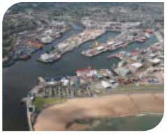
Aberdeen Harbour
|
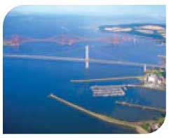
Forth bridges, Forth
|
Bass Rock
|
Forvie Nature Reserve
|
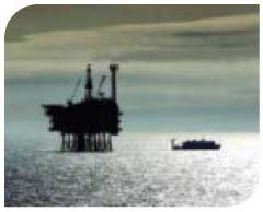
Forties oil platform
|
RRS Discovery, Dundee
|


Condition
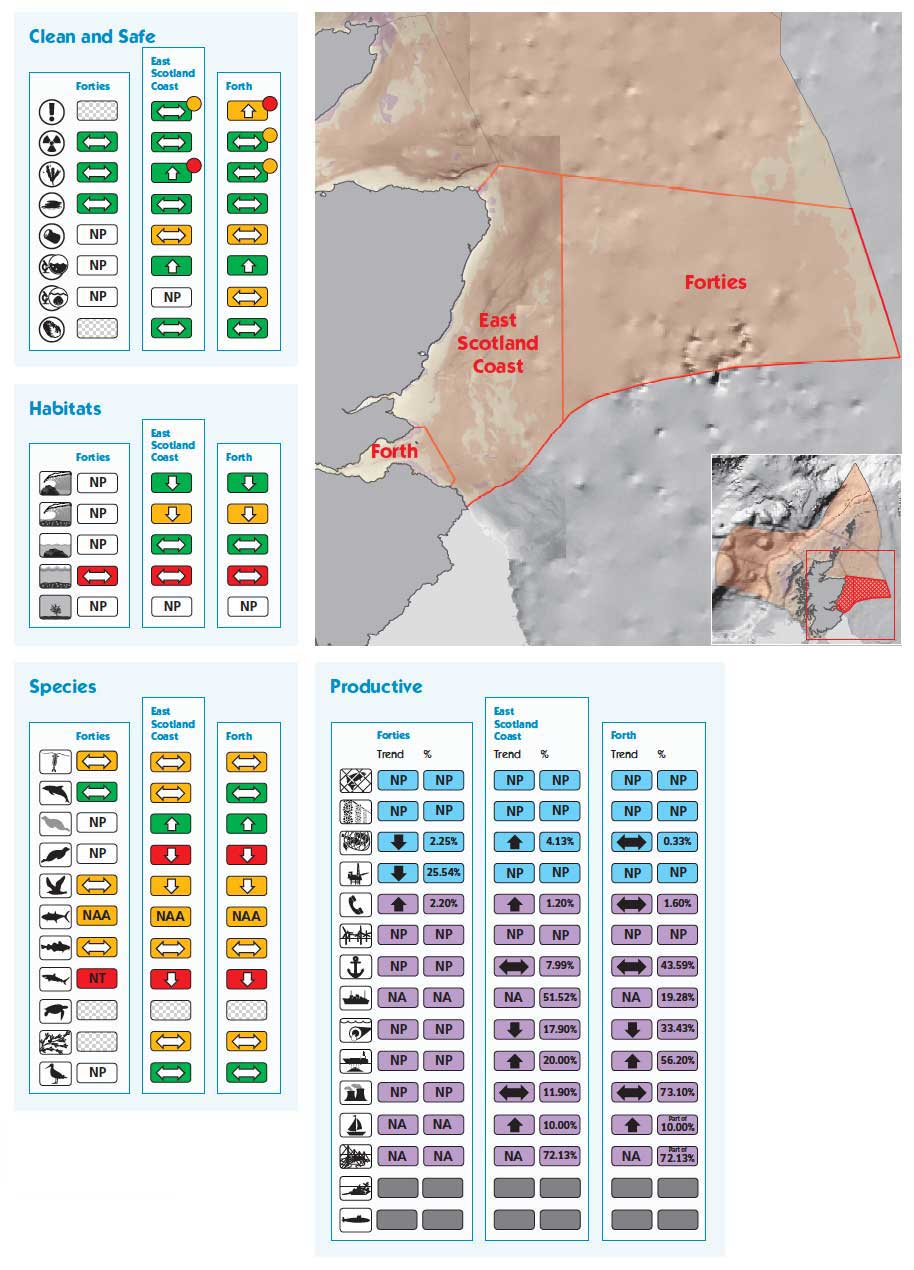
Clean and Safe
At an area level, there are few or no concerns for many of the components assessed (hazardous substances, radioactivity, oil/chemical spills, algal toxins and microbiology of bathing and shellfish waters). However, elevated but decreasing concentrations of hazardous substances are detected in the Forth Estuary.
Water quality in the Forth estuary is compromised by discharges of industrial effluent and treated sewage although effluent treatment has improved resulting in returning populations of residential and migratory fish.
High nutrient inputs from agricultural run-off have resulted in the Ythan Estuary being designated as a 'problem area' for eutrophication and the catchment area as a Nitrate Vulnerable Zone. Measures are in place to reduce these inputs. Similarly, Montrose Basin has been identified as a 'potential problem area' due to elevated nutrients in the South Esk River. Little information is available for the Forties area. Beach litter poses some concerns in the Forth and Tay Estuaries.
Healthy and Biologically Diverse
Intertidal habitats and subtidal rock within the areas are in relatively good condition. In general, subtidal sediments are in poor condition because of considerable pressure from both inshore and offshore fishing activities.
Harbour seals are in a depleted state and continue to decline whereas grey seal numbers are increasing. Most commercially-exploited fish populations are also in a depleted state.
Response/Forward Look
The scale and location of oil and gas exploitation may change as a result of the development of new technologies and oil price rises. Decommissioning of offshore production facilities will become more prominent. Future development of carbon dioxide storage is expected and there is a possibility of exploiting geothermal energy sources under the Firth of Forth. Possible new electricity generation capacity at Longannet, Cockenzie and Boddam could change water abstraction requirements.
There is a significant resource to support the generation of marine renewable energy, mainly from offshore wind. Growth of the industry and development of associated infrastructure, including seabed cables, is anticipated. Further work will be required to understand the effects on seascapes, landscapes and cultural heritage as well as for the cetacean populations. Some smaller coastal ports will provide increasing support during development and operation phases of the renewable energy industry. The Forth has been identified as a possible site to accommodate additional container traffic, which may require associated dredging.
Fishing will continue to be an important industry for the foreseeable future although careful management will be required to ensure future sustainability given the history of over-exploitation in these waters. There is a presumption against finfish farming in these areas.
Closer to the coast, close proximity to centres of population could mean there will be an increase in marine recreation.
Forties
Surface area 24,663 km 2
Maximum depth 218 m
Minimum depth 42 m
Average depth 84 m
East Scotland Coast
Surface area 14,987 km 2
Maximum depth 143 m
Minimum depth 0 m
Average depth 60 m
Forth
Surface area 1,528 km 2
Maximum depth 61 m
Minimum depth 0 m
Average depth 30 m
Area based on high water mark Albers Equal Area Projection. Depths based on 1 arc-minute ETOPO bathymetry. (1)