Scotland's Marine Atlas: Information for The National Marine Plan
Scotland's Marine Atlas is an assessment of the condition of Scotland's seas, based on scientific evidence from data and analysis and supported by expert judgement.
PROTECTED AREAS
Protection of the marine environment is considered of the highest priority, as reflected by the general duty under the Marine (Scotland) Act 2010, 'to act in the way best calculated to further the achievement of sustainable development including the protection and, where appropriate, enhancement of the health ofthat area, so far as is consistent with the proper execution of that function'.
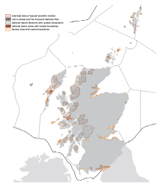
The Wildlife and Countryside Act 1981 as amended by the Nature Conservation (Scotland) Act 2004 provided the mechanism for the designation of Sites of Special Scientific Interest ( SSSI), but these powers only extend down to the limit of mean low water spring tide. At present there are 56 SSSI in Scotland which contain some intertidal and seal features of interest. In addition there are a number of other designations that apply to coastal areas, such as National Parks, National Nature Reserves and National Scenic Areas.
Designated sites
Site of Special Scientific Interest |
Intertidal and Seal Features |
|---|---|
Ballochmartin Bay |
Sand flat |
Balranald Bog and Loch nam Feithean |
Mudflat |
Berwickshire Coast (Intertidal) |
Reefs |
Bogside Flats |
Mudflat |
Bridgend Flats |
Sand flat |
Cree Estuary |
Mudflat |
Cromarty Firth |
Mudflat |
Dornoch Firth |
Eelgrass bed |
East Sanday Coast |
Reef |
Eden Estuary |
Mudflat |
Eynhallow |
Harbour seal |
Faray and Holm of Faray |
Grey seal |
Firth of Forth |
Saline lagoon |
Gribun Shore and Crags |
Mudflat |
Gruinart Flats |
Mudflat |
Howmore Estuary, Lochs Roag and Fada |
Saline lagoon |
Isle of May |
Grey seal |
Kames Bay |
Sand flat |
Kentra Bay and Moss |
Mudflat |
Loch an Duin |
Tidal rapids |
Loch Bee |
Saline lagoon |
Loch Fleet |
Eelgrass bed |
Loch Moidart |
Mudflat |
Loch nam Madadh |
Reefs |
Loch Obisary |
Saline lagoon |
Loch Siadar |
Tidal rapids |
Lochs at Clachan |
Saline lagoon |
Lochs of Harray and Stenness |
Saline lagoon |
Longman and Castle Stuart Bays |
Eelgrass bed |
Luskentyre Banks and Saltings |
Sand flat |
Lynn of Lorn Small Islands |
Common seal |
Montrose Basin |
Mudflat |
Mound Alderwoods |
Saline lagoon |
Mousa |
Common seal |
Muckle and Little Green Holm |
Grey seal |
Munlochy Bay |
Mudflat |
North Fetlar |
Grey seal |
North Rona and Sula Sgeir |
Grey seal |
Northton Bay |
Saline lagoon |
Obain Loch Euphoirt |
Saline lagoon |
Oronsay and South Colonsay |
Grey seal |
Papa Stour |
Reefs |
Pool of Virkie |
Mudflat |
Rosehearty to Fraserburgh Coast |
Mudflat |
Sandness Coast |
Reefs |
Small Seal Islands |
Grey seal |
Sunart |
Reefs |
Taynish Woods |
Reefs |
Tayport - Tentsmuir Coast |
Mudflat |
The Vadills |
Tidal rapids |
Tob Valasay |
Tidal rapids |
Tong Saltings |
Mudflat |
Treshnish Isles |
Grey seal |
Ulva, Danna and the McCormaig Isles |
Mudflat |
Upper Solway Flats and Marshes |
Mudflat |
Whiteness Head |
Mudflat |
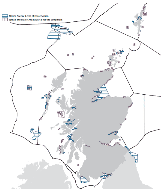
Natura 2000 sites, Special Protection Areas ( SPA) and Special Areas of Conservation ( SAC) designated respectively under two European directives, Directive 79/409/ EEC (otherwise known as the Birds Directive) and Council Directive 92/43/ EEC (otherwise known as the Habitats Directive) represent some of the very best of Scotland's marine natural heritage.
The Birds Directive provides member states with the responsibility to classify Special Protection Areas to protect birds which are rare, or vulnerable, in Europe as well as all migratory birds which are regular visitors. There are currently 58 SPA in Scotland with marine/coastal components, and of these, 31 of the seabird breeding colony SPA have recently had their boundaries extended by either 1.2 or 4.0km into the adjacent marine environment (marked with an * in the table below). At present there are no entirely marine SPA in Scotland although work is underway to identify areas important for inshore aggregations of non-breeding waterbirds and for offshore aggregations of seabirds. (see jncc website jncc/gov.uk/pdf/SPA_AOS_Maps%2020100304.pdf)
Natura 2000 sites
Special Protection Areas which are within or have links to the marine environment
The SPAs listed in the table comprise:
1. Sites which support true seabirds i.e. truly marine birds - auks, gulls, terns, petrels, gannets, etc.
2. Sites which support species which, at times, use maritime habitats.
3. Sites which include maritime habitats which are sometimes used by terrestrial species. 'Waterfowl' is used to include seaduck, waders and divers. 'Seabirds' is used to refer to the 24 species of seabirds listed in the Seabirds Section and Mitchell et al. (2004). 1
Special Protection Areas |
Summary interests |
|---|---|
Ailsa Craig * |
seabirds |
Auskerry |
seabirds |
Buchan Ness to Collieston * |
seabirds |
Caithness and Sutherland Peatlands |
waterfowl |
Calf of Eday * |
seabirds |
Canna & Sanday * |
seabirds |
Cape Wrath * |
seabirds |
Copinsay * |
seabirds |
Cromarty Firth |
waterfowl, seabirds |
Dornoch Firth & Loch Fleet |
waterfowl, seabirds |
East Caithness Cliffs * |
seabirds |
East Sanday Coast |
waterfowl |
Fair Isle * |
seabirds |
Fetlar * |
seabirds |
Firth of Forth |
waterfowl |
Firth of Tay & Eden Estuary |
seabirds, waterfowl |
Flannan Isles * |
seabirds |
Forth Islands * |
seabirds |
Foula * |
seabirds, waterfowl |
Fowlsheugh * |
seabirds |
Glas Eileanan |
seabirds |
Gruinard Flats |
waterfowl |
Handa * |
seabirds |
Hermaness, Saxa Vord & Vallafield * |
seabirds, waterfowl |
Hoy * |
seabirds, waterfowl |
Imperial Dock Lock |
seabirds |
Inner Clyde |
waders |
Inner Moray Firth |
waterfowl, seabirds |
Lewis Peatlands |
waterfowl |
Loch of Strathbeg |
waterfowl, seabirds |
Marwick Head * |
seabirds |
Mingulay & Berneray * |
seabirds |
Mointeach Scadabhaigh |
waterfowl |
Monach Islands |
seabirds |
Montrose Basin |
waterfowl |
Moray & Nairn Coast |
waterfowl |
Mousa |
seabirds |
North Caithness Cliffs * |
seabirds |
North Colonsay & Western Cliffs * |
seabirds |
North Rona and Sula Sgeir * |
seabirds |
North Uist Machair & Islands |
waterfowl |
Noss * |
seabirds |
Orkney Mainland Moors |
waterfowl |
Otterswick and Graveland |
waterfowl |
Papa Stour |
seabirds |
Papa Westray |
seabirds |
Pentland Firth Islands |
seabirds |
Priest Island |
seabirds |
Ramna Stacks & Gruney |
seabirds |
Ronas Hill - North Roe & Tingon |
waterfowl, seabirds |
Rousay * |
seabirds |
Rum * |
waterfowl, seabirds |
Shiant Isles * |
seabirds |
Sleibhtean agus Cladach Thiriodh |
waterfowl |
South Uist Machair & Lochs |
waterfowl, seabirds |
St Abb's Head to Fast Castle * |
seabirds |
St Kilda * |
seabirds |
Sule Skerry & Sule Stack * |
seabirds |
Sumburgh Head * |
seabirds |
Treshnish Isles |
seabirds |
Troup, Pennan & Lion's Heads * |
seabirds |
Upper Solway Flats & Marshes |
waterfowl |
West Westray * |
seabirds |
Ythan Estuary, Sands of Forvie & Meikle Lochs |
waterfowl, seabirds |
1 Seabird Populations of Britain and Ireland: Results of the 'Seabird 2000' Census 1999-2002.
The Scottish Government is committed to establishing a well managed, ecologically coherent network of Marine Protected Areas through OSPAR for a number of marine habitats and species considered to be under threat or in decline, as well as others that are representative of Scotland's marine environment.
Scotland has international commitments to establish an ecologically coherent network of Marine Protected Areas ( MPAs) by the end of 2012. Existing protected areas ( SACs, SPAs, SSSIs and Ramsar sites) will make a significant contribution to the network but are limited in their ability to recognise features of national importance in the marine environment. There is considerable overlap between the OSPAR list of threatened and/or declining species and the list of Marine Protected Area search features which have been identified to help underpin the development of the MPA network in Scotland's seas.
The Marine (Scotland) Act 2010 and the UK Marine and Coastal Access Act 2009 both include powers to designate Marine Protected Areas ( MPAs) in the seas around Scotland to enable the network to be completed.
Under the Marine (Scotland) Act 2010 there are three different types of MPAs that can be designated in territorial waters:
- Nature Conservation MPAs
- Demonstration and Research MPAs
- Historic MPAs.
Following the Ministerial Statement on MPAs in March 2010, the Scottish MPA Project was established with the aim of providing advice to Scottish Ministers on the selection of MPAs and development of the MPA network. Identification of MPAs will be carried out by the end of 2012. The Scottish MPA Selection Guidelines set out the selection process and highlight the opportunities for stakeholders to become involved. There will be one network in the seas around Scotland which will contribute towards UK, North-East Atlantic and global networks.
See the Selection Guidelines at www.scotland.gov.uk/marinescotland/mpaguidelines
Species |
OSPAR Feature |
PA search feature |
|---|---|---|
Arachnanthus sarsi |
v |
|
Leptometra celtica |
v |
|
Atrina pectinata |
v |
|
Glossus humanus |
v |
|
Arctica islandica |
v |
v |
Nucella lapillus |
v |
|
Ostrea edulis |
v |
|
Palinurus elephas |
v |
|
Rissa tridactyla |
v |
|
Sterna dougalii |
v |
|
Cepphus grille |
v |
|
Alosa alosa |
v |
|
Anguilla anguilla |
v |
|
Centroscymus coelolepis |
v |
|
Centrophorus squamosus |
v |
|
Cetorhinus maximus |
v |
v |
Dipturus batis |
v |
v |
Raja montagui |
v |
|
Gadus morhua |
v |
|
Hoplostethus atlanticus |
v |
v |
Lamna nasus |
v |
|
Raja clavata |
v |
|
Molva dypterygia |
v |
|
Ammodytes spp. |
v |
|
Salmo salar |
v |
|
Squalus acanthias |
v |
|
Squatina squatina |
v |
|
Caretta caretta |
v |
|
Dermochelys coriacea |
v |
|
Balaenoptera musculus |
v |
|
Eubalaena glacialis |
v |
|
Phocoena phocoena |
v |
|
Balaenoptera acutorostrata |
v |
|
Grampus griseus |
v |
|
Lagenorhynchus albirostris |
v |
Habitats |
OSPAR Feature |
MPA search feature |
|---|---|---|
Coral gardens |
v |
v |
Deep sea sponge aggregations |
v |
v |
Blue mussel beds |
v |
v |
Intertidal mudflats |
v |
|
Cold water coral reefs |
v |
|
Maerl beds |
v |
v |
Maerl or coarse shell gravel with burrowing sea cucumbers |
v |
|
Horse mussel beds |
v |
v |
Native oysters |
v |
v |
Sabellaria spinulosa reefs |
v |
|
Seamount communities |
v |
v |
Sea pen and burrowing megafauna communities |
v |
v |
Seagrass beds |
v |
v |
Carbonate mound communities |
v |
|
Flame shell beds |
v |
|
Inshore deep mud with burrowing heart urchins |
v |
|
Kelp and seaweed communities on sublittoral sediment |
v |
|
Low or variable salinity habitats |
v |
|
Northern sea fan and sponge communities |
v |
|
Offshore deep sea muds |
v |
|
Offshore subtidal sands and gravel |
v |
|
Sea loch egg wrack beds |
v |
|
Serpulid aggregations |
||
Shallow tide-swept coarse sands and burrowing bivalves |
v |
|
Shelf banks and mounds |
v |
|
Shelf deeps |
v |
|
Shelf fronts |
v |
|
Tide-swept algal communities |
v |
Summary of condition of marine habitats and species on designated sites in Scotland (as at January 2011)
Feature |
Number of features |
Number of features assessed |
Favourable |
Unfavourable recovering |
Unfavourable |
|---|---|---|---|---|---|
Habitats |
129 |
96 |
94 |
1 |
1 |
Mammals |
50 |
49 |
42 |
2 |
5 |
Species |
4 |
3 |
3 |
0 |
0 |
Seabirds |
470 |
464 |
261 |
12 |
191 |
Waterfowl |
250 |
248 |
208 |
0 |
40 |
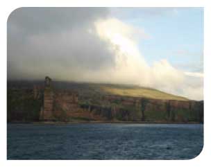
Hoy coast
|
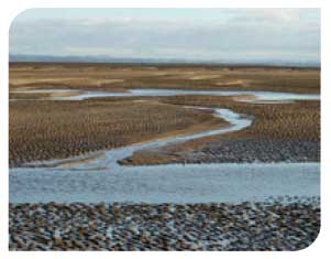
Eden Estuary
|
The Habitats Directive is a major contribution by the European Community to implementing the Biodiversity Convention agreed in Rio in 1992. Special Areas of Conservation ( SACs) are designated for particular habitats and species which are listed in annexes to the directive. There are eight habitat types and four species listed on Annexes I and II respectively for which there are marine SACs designated in Scotland. Some sites contain more than one feature. There are currently 34 marine SACs covering ~4% of the total area of territorial waters within 12nm. There are also six offshore SACs that have either been designated or proposed.
Isle of May
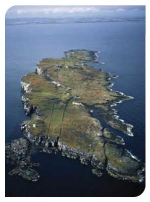
© P&A Macdonald/ SNH
Loch of Stenness
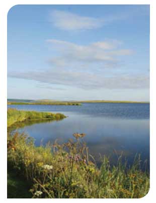
© John M Baxter
Special Areas of Conservation |
Interest Features |
|---|---|
Ascrib, Isay and Dunvegan |
Harbour seals |
Berwickshire and North Northumberland coast |
Mudflats and sandflats not covered by seawater at low tide |
Braemar Pockmarks |
Submarine structures made by leaking gases |
Darwin Mounds |
Reefs |
Dornoch Firth and Morrich More |
Estuary |
Eileanan agus Sgeiran Lios mor |
Harbour seals |
Faray and Holm of Faray |
Grey seals |
Firth of Lorn |
Reefs |
Firth of Tay and Eden estuary |
Estuary |
Isle of May |
Reefs |
Loch Creran |
Reefs |
Lochs Duich, Long and Alsh |
Reefs |
Loch Laxford |
Large shallow inlets and bays |
Loch Moidart and Loch Shiel Woods |
Mudflats and sandflats not covered by seawater at low tide |
Loch nam Madadh |
Large shallow inlets and bays |
Loch of Stenness |
Lagoons |
Loch Roag Lagoons |
Lagoons |
Luce Bay and Sands |
Large shallow inlets and bays |
Moine Mhor |
Mudflats and sandflats not covered by seawater at low tide |
Monach Isles |
Grey seals |
Moray Firth |
Sandbanks which are slightly covered by seawater all the time |
Mousa |
Reefs |
North Rona |
Reefs |
North West Rockall Bank |
Reefs |
Obain Loch Euphoirt |
Lagoons |
Papa Stour |
Reefs |
St Kilda |
Reefs |
Sanday |
Reefs |
Scanner Pockmark |
Submarine structures made by leaking gases |
Solway Firth |
Sandbanks which are slightly covered by seawater all the time |
Sound of Arisaig |
Sandbanks which are slightly covered by seawater all the time |
South-east Islay Skerries |
Harbour seals |
South Uist Machair |
Lagoons |
Stanton Banks |
Reefs |
Sullom Voe |
Reefs |
Sunart |
Reefs |
The Vadills |
Lagoons |
Treshnish Islands |
Reefs |
Wyville Thomson Ridge |
Reefs |
Yell Sound Coast |
Harbour seals |
* There are further SACs identified for otters but these are entirely terrestrial and freshwater sites and have no marine component.
Offshore SACs