
Fisheries Management Measures within Scottish Inshore Marine Protected Areas (MPAs) and Proposed Priority Marine Feature (PMF) Management Areas - High level Site Summary Details and Potential Impacts of Proposed Fisheries Management Measures
Overview of site and area details and potential impacts of the proposed fisheries management measures within Scottish Inshore Marine Protected Areas (MPAs) and proposed Priority Marine Feature (PMF) management areas

10. Clyde Scottish Marine Region Proposed PMF Management Areas
Due to the complexity and large number of areas, the estimated socio-economic impacts of proposed measures data has been produced at a regional level, allowing for a more consistent assessment across wider geographical scales while still capturing key variations in ecological, social, and economic value. Some values may not be disclosed for confidentiality reasons, as it relates to the operations of fewer than three vessels. Sites with a proposed single management option will be option 2.
|
Socio-Economic Impact |
Option 1 |
Option 2 |
|---|---|---|
|
Average annual loss in value of landings (£000s, 2022 prices) |
0 - 6.9 |
0 - 12.4 |
|
Direct + indirect reduction in GVA (PV) impact (£000s) 20 years |
0 - 50.6 |
0 - 91.6 |
|
Average (mean) number of direct + indirect jobs (year on year, over 20 years), Full Time Equivalents |
0 - 0.1 |
0 - 0.1 |
|
Environmental Impact |
Option 1 |
Option 2 |
|---|---|---|
|
Benefits within the sites/areas |
Major beneficial |
Major beneficial |
|
Spill over benefits |
Negligible beneficial |
Negligible beneficial |
|
Displacement effects |
Negligible adverse |
Negligible adverse |
|
Effects from other gear types |
Negligible adverse |
Negligible adverse |
|
Estimated overall environmental impact |
Benefit |
Benefit |
10.1. Single Proposed Management Option
PMF management areas will be closed to demersal trawls and seines, beam trawls, mechanical dredges, and hydraulic dredges. This is because the features present in these areas are sensitive to these gear types.
A single management option has been developed for the following 3 PMF management areas. Only one option was identified due to one of, or combination of, evidence (fishing activity or PMF related), boundary setting principles and compliance considerations.
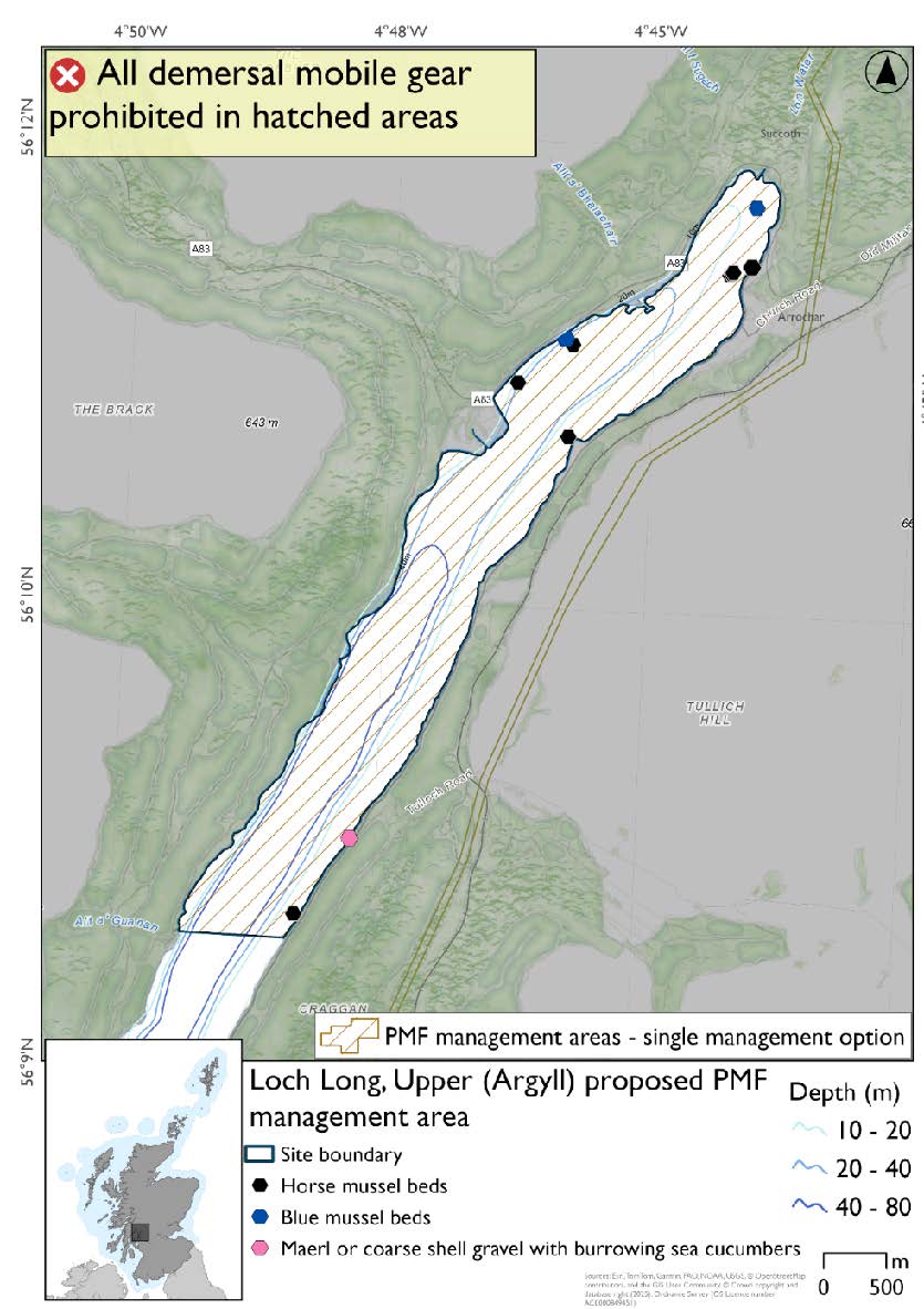
10.1.1. Area: Loch Long, Upper (Argyll)
No additional fishing data were provided within the proposed PMF management area.
Feature: Blue mussel beds, horse mussel beds, and maerl or coarse shell gravel with burrowing sea cucumbers.
Figure 32. Map of measures proposed:
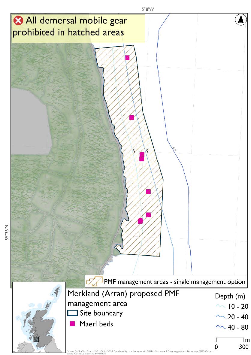
10.1.2. Area: Merkland (Arran)
The area was adjusted to incorporate a suitable buffer around the records but still accommodating additional fishing data that was provided.
Feature: Maerl beds
Figure 33. Map of measures proposed:
10.1.3. Area: Sannox (Arran)
The boundary was reduced to where maerl bed records are located with sufficient buffer. No additional fishing data were provided within the proposed management area.
Feature: Maerl beds
Figure 34. Map of measures proposed:

10.2. Two Proposed management options:
PMF management areas will be closed to demersal trawls and seines, beam trawls, mechanical dredges, and hydraulic dredges. This is because the features present in these areas are sensitive to these gear types.
Two options have been developed for the following 6 PMF management areas. Option 1 reflects a smaller footprint that reflects one, or a combination of evidence (fishing activity or PMF related), boundary setting principles and compliance considerations. Option 2 covers a larger footprint that offers improved protection.
10.2.1. Area: Ardlamont Point (Cowal)
Feature: Maerl beds and maerl or coarse shell gravel with burrowing sea cucumbers
Option 1:* This boundary covers a smaller footprint more closely following depths suitable for maerl beds and accommodating additional fishing activity data where possible.
Figure 35. Map of measures proposed under option 1:

*The maerl or coarse shell gravel with burrowing sea cucumbers record is amongst the large cluster of maerl bed records.
Option 2:* This boundary covers a larger footprint that offers improved protection.
Figure 36. Map of measures proposed under option 2:
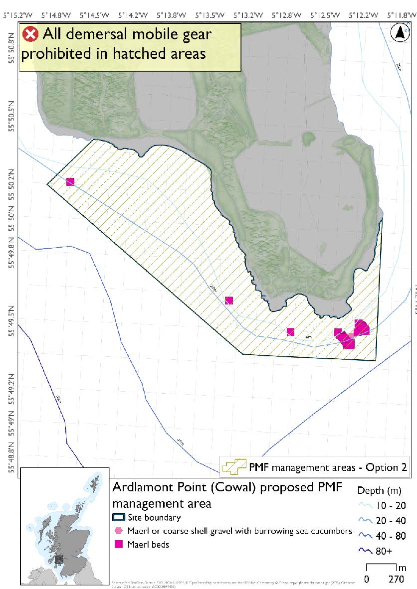
*The maerl or coarse shell gravel with burrowing sea cucumbers record is amongst the large cluster of maerl bed records.
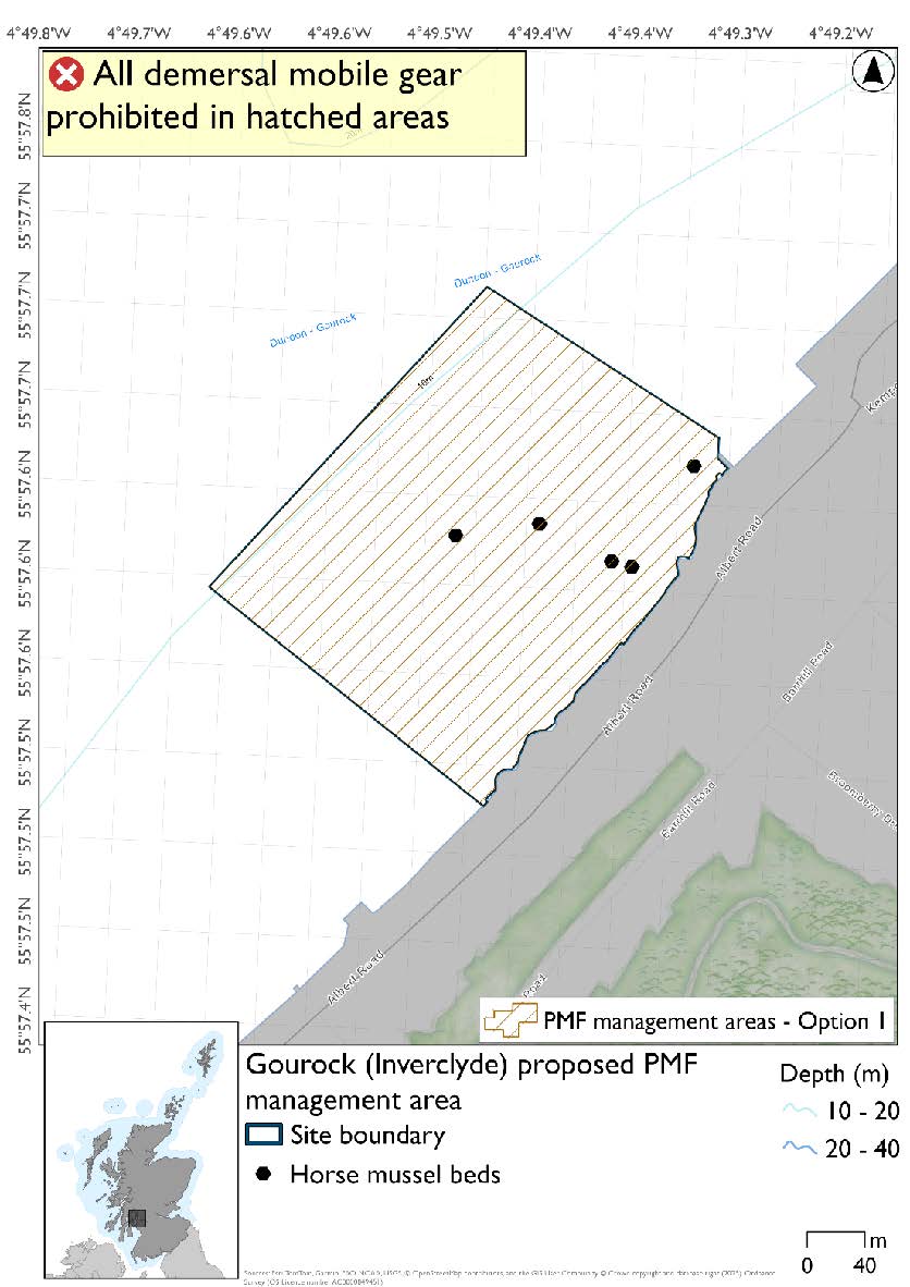
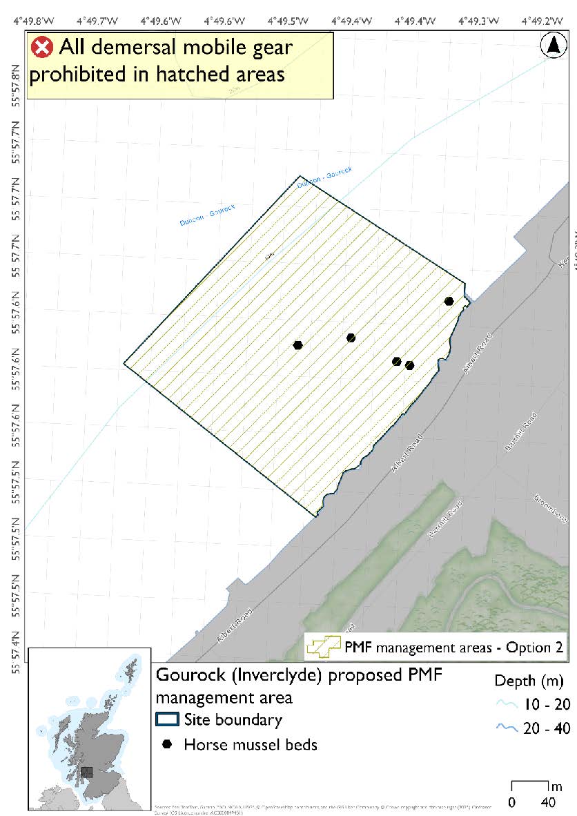
10.2.2. Area: Gourock (Inverclyde)
Feature: Horse mussel beds
Option 1: Smaller footprint to accommodate additional fishing data provided around the edges of the area, whilst giving sufficient buffers for the features.
Figure 37. Map of measures proposed under option 1:
Option 2: This boundary covers a larger footprint that offers improved protection.
Figure 38. Map of measures proposed under option 2:
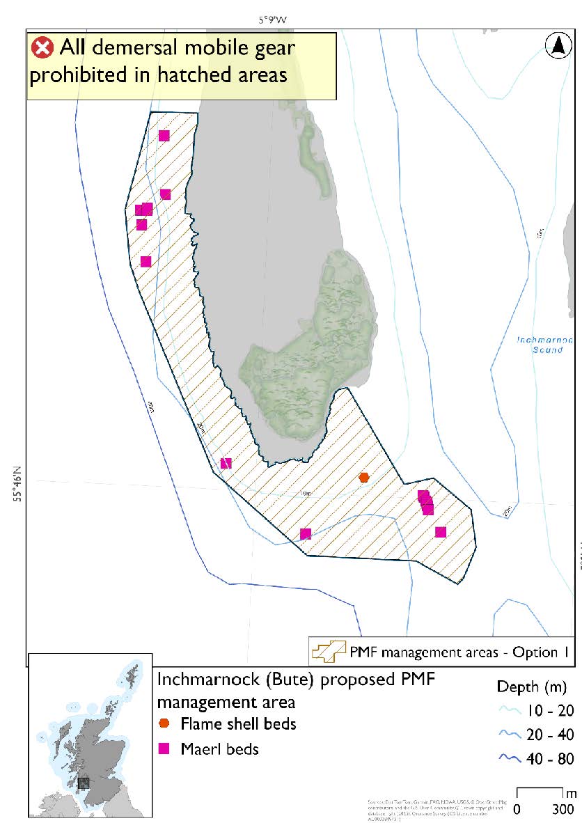
10.2.3. Area: Inchmarnock (Bute)
Feature: Maerl beds
There are also flame shell bed records present, but they were not a focus for area selection as further work is needed to confirm its status.
Option 1: This boundary covers a smaller footprint more closely following extent of known PMFs and depths suitable for maerl beds, and accommodating fishing data provided whilst protecting the PMF records.
Figure 39. Map of measures proposed under option 1:
Option 2: This boundary covers a larger footprint that offers improved protection.
Figure 40. Map of measures proposed under option 2:

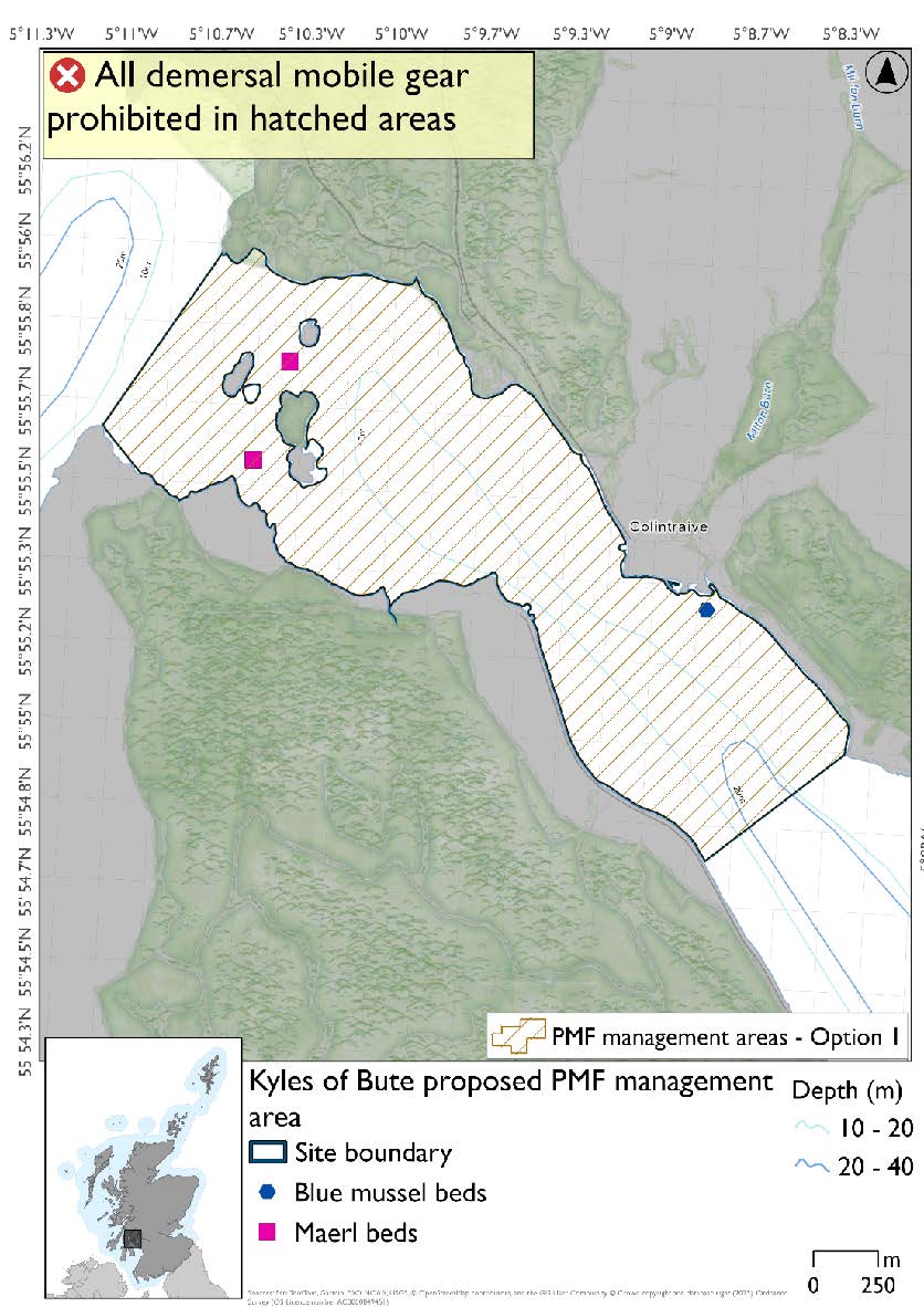
10.2.4. Area: Kyles of Bute
Feature: Maerl beds
There are also intertidal blue mussel beds records present, but they were not considered part of this process due to there being no overlaps with bottom-contacting fisheries and intertidal mussel beds.
Option 1: This boundary covers a smaller footprint, excluding the very degraded maerl bed records in the southeast and the deeper muddy and mixed sediment habitats in the central channel and accommodates additional fishing data that was provided whilst protecting the PMF records.
Figure 41. Map of measures proposed under option 1:
Option 2: This boundary covers a larger footprint and includes very degraded maerl bed records in the southeast.
Figure 42. Map of measures proposed under option 2:

10.2.5. Area: Skipness Point (Kintyre)
Feature: Maerl beds
Option 1: This boundary covers a smaller footprint accommodating additional fishing data provided with suitable buffer in place for the maerl beds.
Figure 43. Map of measures proposed under option 1:

Option 2: This boundary covers a larger footprint that offers improved protection.
Figure 44. Map of measures proposed under option 2:

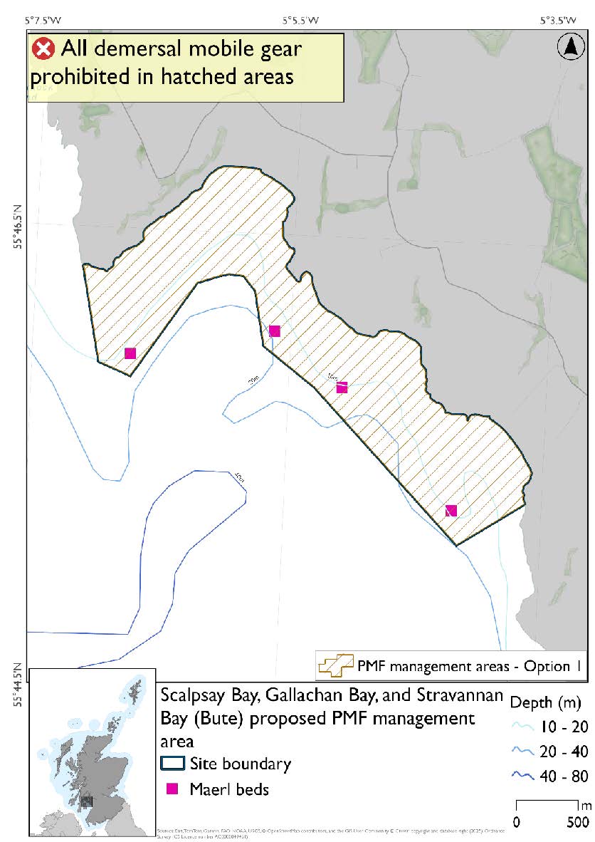
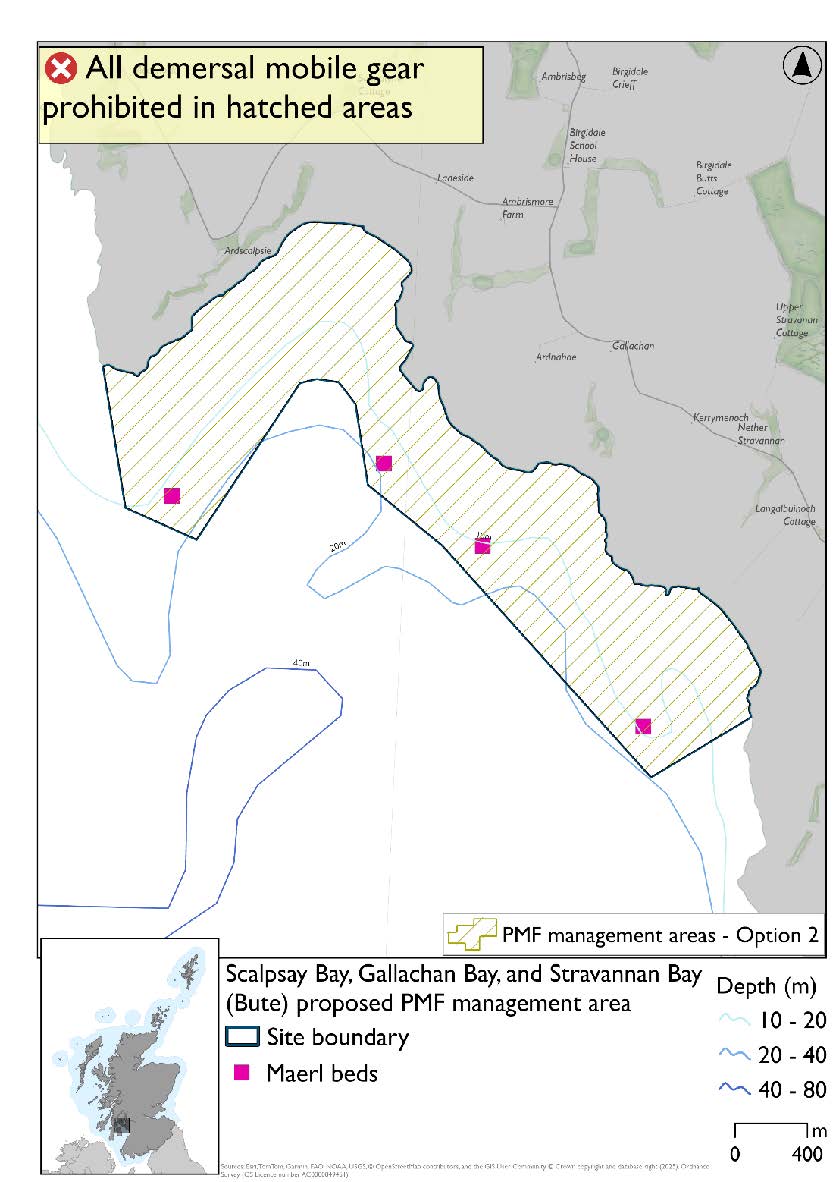
10.2.6. Area: Scalpsay Bay, Gallachan Bay, and Stravannan Bay (Bute)
Feature: Maerl beds
Option 1: This boundary covers a smaller footprint. This reflects more closely the depths suitable for maerl beds in the north of the area and accommodates additional fishing data provided with suitable buffers around maerl bed records.
Figure 45. Map of measures proposed under option 1:
Option 2: This boundary covers a larger footprint that offers improved protection around the most westerly maerl bed record.
Figure 46. Map of measures proposed under option 2:
Contact
Email: marine_biodiversity@gov.scot