Scottish islands: data overview 2023
This report gives a snapshot of Scotland's island-level data as collated in the new Scottish Islands Data Dashboard and draws out key findings relating to each of the strategic objective topic areas set out in the National Islands Plan.
2 Island Geographies
2.1 Local Authority
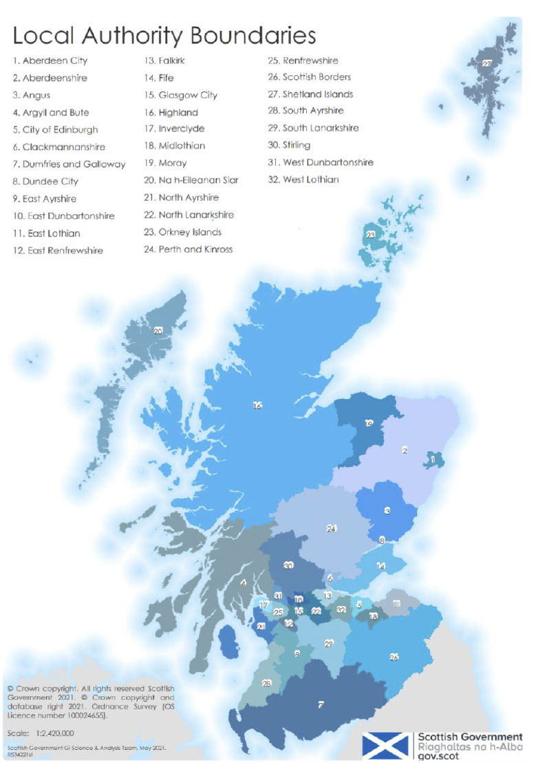
Scotland is divided into 32 administrative areas for the purposes of local government. According to the Islands (Scotland) Act (2018), there are 6 Local Authorities which contain inhabited, offshore islands.
Shetland Islands Council, Orkney Islands Council, and Comhairle nan Eilean Siar are Local Authorities which are completely made up of islands. However, Argyll and Bute Council, Highland Council and North Ayrshire Council encompass a significant amount of mainland in addition to islands.
It is therefore important to note that the majority of the population in Argyll and Bute Council, Highland Council and North Ayrshire Council is not island based. As such, Local Authority statistics should be interpreted with caution.
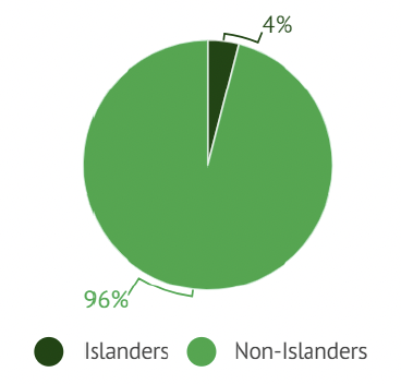
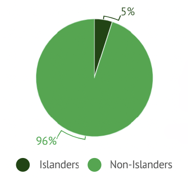
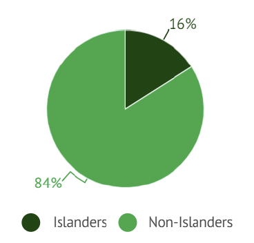
Source: Population breakdowns calculated by National Records of Scotland using the Mid-2021 Small Area Population Estimates and the Population Estimates of Scottish Island Regions.
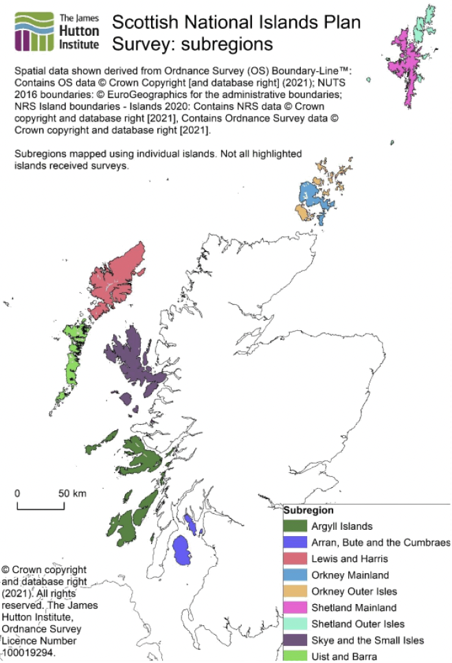
2.2 Island Groupings
The James Hutton Institute framework was created to reflect some of the diversity of islands within Local Authority areas and connections across these areas (i.e. for the Clyde Islands). The framework groups Scotland’s islands into 9 distinct subregions, as illustrated on this map. The subregions were created from a subset of 100 islands from the National Records of Scotland (NRS) Islands 2020 product. All of the islands which were selected for inclusion were classed as inhabited or previously inhabited based on the 2020-2 Scottish Postcode Directory (i.e. they contained at least one Royal Mail Delivery Point).
Contact
Email: socialresearch@gov.scot