Sectoral marine plan: appropriate assessment

Assessment of the implications of the sectoral marine plan for offshore wind energy for designated special areas of conservation special protection areas, candidate special areas of conservation and proposed special protection areas in view of the sites' conservation objectives.


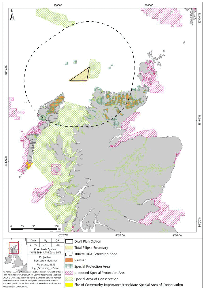
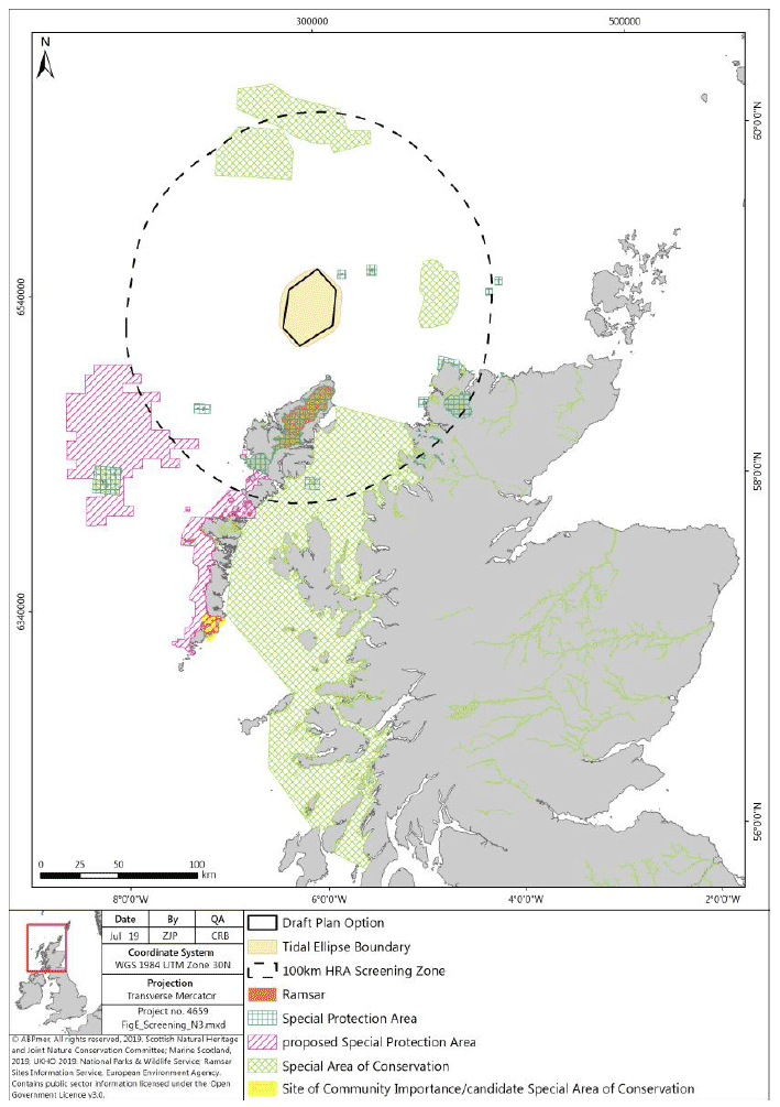
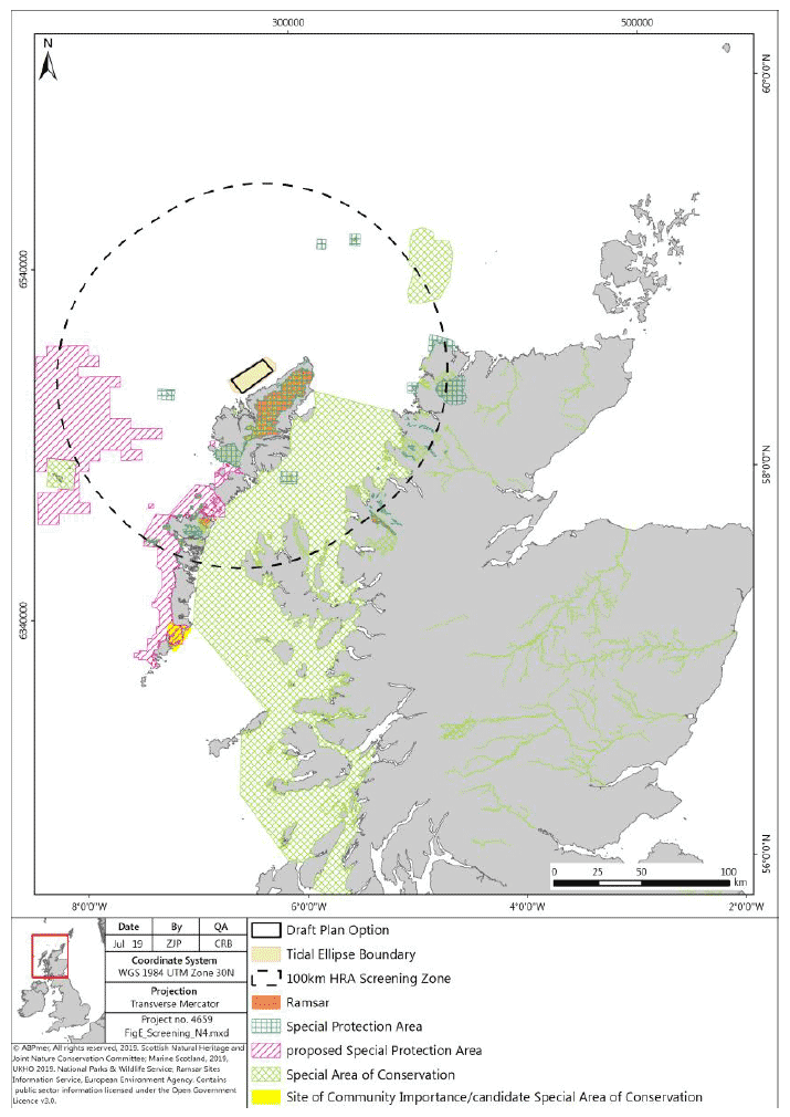
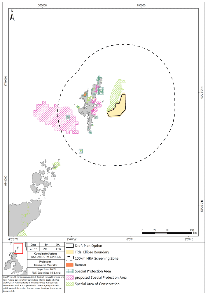
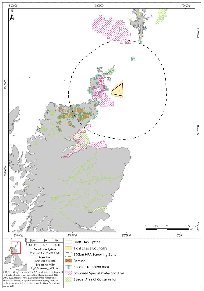
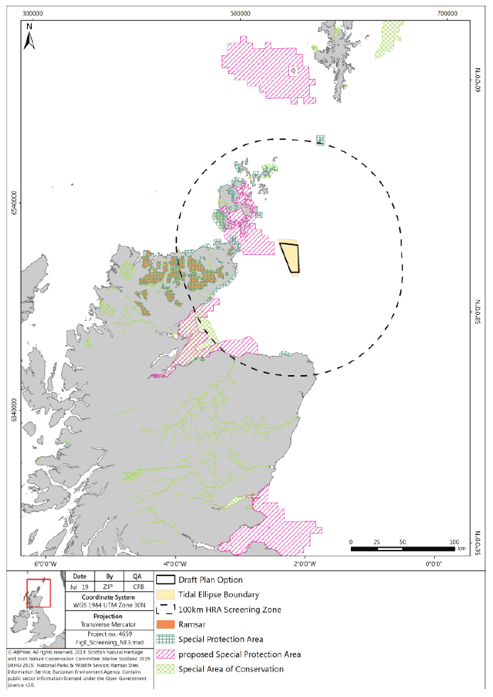
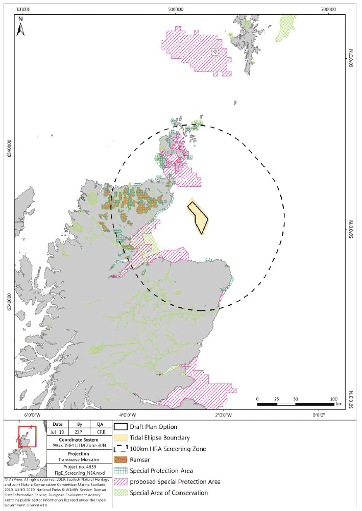
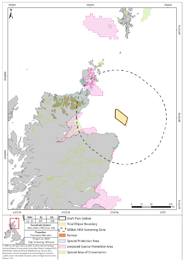
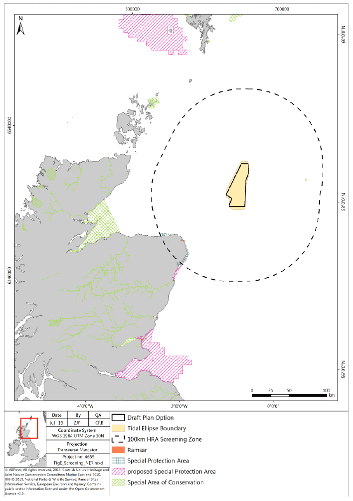
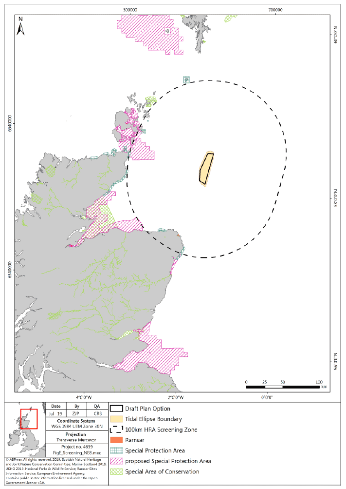
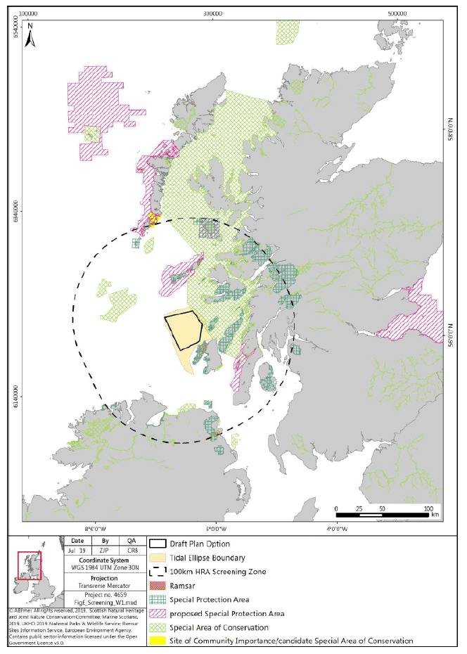
Appendix Three: Screening Maps - Per DPO

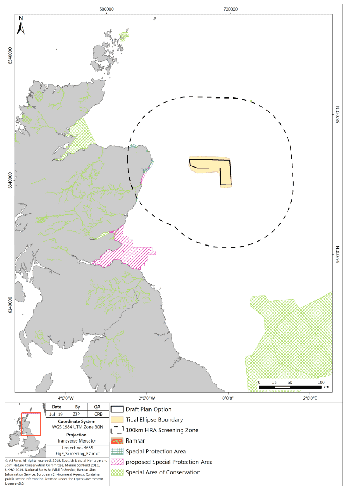
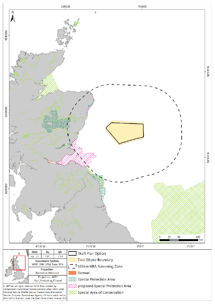
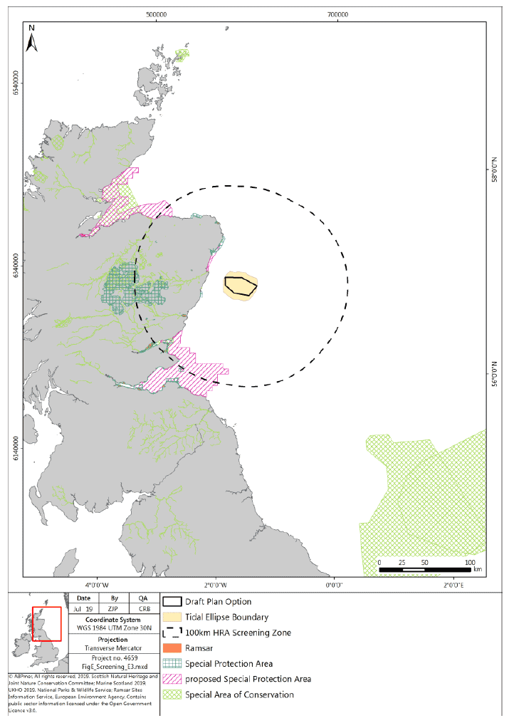
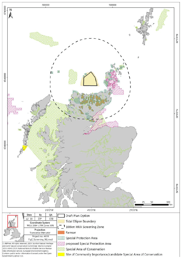
The figures below provide an overview of the screening maps per DPO (please note, maps for DPOs SW1 and NE5 have not been included here as these DPOs have not been chosen to progress as final Plan Options).

A 100 km buffer was used in the screening process (as agreed with the Steering Groups), which captured all sites within the buffer, irrespective of the foraging ranges of the designated species. Where Thaxter et al identified species with mean max. foraging ranges larger than the 100 km buffer, the mean max. foraging ranges were used to screen in additional SPA and Ramsar sites, including;

  • Atlantic puffin (105 km);
  • Lesser black-backed gull (141 km);
  • Manx Shearwater (330 km);
  • Northern Fulmar (400 km); and
  • Northern Gannet (229 km).

These maps are also included at Appendix E of the HRA Report (2019).

Figure 9 Screening map - DPO E2
Map of the various designated sites in Scotland SPA, pSPA, Special Areas of Conservation, Ramsar, the tidal ellipse boundary and the 100 KM screening boundary around Plan option E2
Figure 10 Screening table - DPO E1
Map of the various designated sites in Scotland SPA, pSPA, Special Areas of Conservation, Ramsar, the tidal ellipse boundary and the 100 KM screening boundary around Plan option E1
Figure 11 Screening map - DPO E3
Map of the various designated sites in Scotland SPA, pSPA, Special Areas of Conservation and Ramsar, the tidal ellipse boundary and the 100 KM screening boundary around Plan option E3
Figure 12 Screening map - DPO N1
Map of the various designated sites in Scotland SPA, pSPA, Special Areas of Conservation, candidate SAC and Ramsar, the tidal ellipse boundary and the 100 KM screening boundary around Plan option N1
Figure 13 Screening map - DPO N2
Map of the various designated sites in Scotland SPA, pSPA, Special Areas of Conservation, candidate SAC and Ramsar, the tidal ellipse boundary and the 100 KM screening boundary around Plan option N2
Figure 14 Screening map - DPO N3
Map of the various designated sites in Scotland SPA, pSPA, Special Areas of Conservation, candidate SAC and Ramsar, the tidal ellipse boundary and the 100 KM screening boundary around Plan option N3
Figure 15 Screening map - DPO N4
Map of the various designated sites in Scotland SPA, pSPA, Special Areas of Conservation, candidate SAC and Ramsar, the tidal ellipse boundary and the 100 KM screening boundary around Plan option N4
Figure 16 Screening map - DPO NE1
Map of the various designated sites in Scotland SPA, pSPA, Special Areas of Conservation and Ramsar, the tidal ellipse boundary and the 100 KM screening boundary around Plan option NE1
Figure 17 Screening map - DPO NE2
Map of the various designated sites in Scotland SPA, pSPA, Special Areas of Conservation and Ramsar, the tidal ellipse boundary and the 100 KM screening boundary around Plan option NE2
Figure 18 Screening map - DPO NE3
Map of the various designated sites in Scotland SPA, pSPA, Special Areas of Conservation and Ramsar, the tidal ellipse boundary and the 100 KM screening boundary around Plan option NE3
Figure 19 Screening map - DPO NE4
Map of the various designated sites in Scotland SPA, pSPA, Special Areas of Conservation and Ramsar, the tidal ellipse boundary and the 100 KM screening boundary around Plan option NE4
Figure 20 Screening map - DPO NE6
Map of the various designated sites in Scotland SPA, pSPA, Special Areas of Conservation and Ramsar, the tidal ellipse boundary and the 100 KM screening boundary around Plan option NE6
Figure 21 Screening map - DPO NE7
Map of the various designated sites in Scotland SPA, pSPA, Special Areas of Conservation and Ramsar, the tidal ellipse boundary and the 100 KM screening boundary around Plan option NE7
Figure 22 Screening map - DPO NE8
Map of the various designated sites in Scotland SPA, pSPA, Special Areas of Conservation and Ramsar, the tidal ellipse boundary and the 100 KM screening boundary around Plan option NE8
Figure 23 Screening map - DPO W1
– Map of the various designated sites in Scotland SPA, pSPA, Special Areas of Conservation and Ramsar, the tidal ellipse boundary and the 100 KM screening boundary around Plan option W1

Contact

Email: sectoralmarineplanning@gov.scot

Back to top