Scottish Islands Data Overview (2025)
The Scottish Islands Data Dashboard has been updated following a review of available data. This report summarises the findings. It highlights changes between data available in 2025 and data first collated in 2023 and gives an overview of longer term trends in Scotland's Islands.
2 Island Geographies
2.1 Local Authority Island geography
Scotland is divided into 32 administrative areas for the purposes of local government. According to the Islands (Scotland) Act (2018), there are six local authorities which contain inhabited, offshore islands.
Shetland Islands Council, Orkney Islands Council, and Comhairle nan Eilean Siar are local authorities which are completely made up of islands. However, Argyll and Bute Council, Highland Council and North Ayrshire Council encompass a significant amount of mainland in addition to islands.
It is therefore important to note that the majority of the population in Argyll and Bute Council, Highland Council and North Ayrshire Council is not island based. As such, local authority statistics should be interpreted with caution.
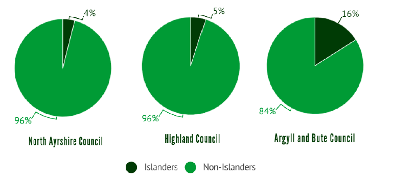
Source: Mid-2021 Small Area Population Estimates and the Population Estimates of Scottish Island Regions.
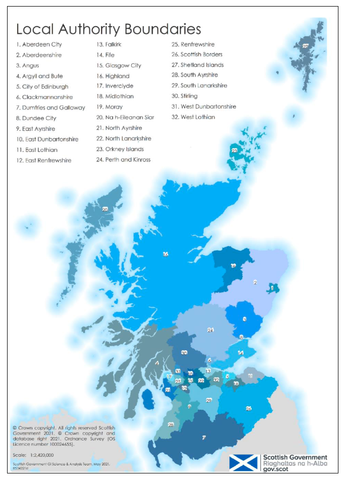
Source: Scottish Government, 2021
2.2 Scottish Island Regions
The Scottish Island Regions (2023) provide a new geography for grouping Scotland’s islands into nine different regions. Used in the Scottish Islands Survey (2023), it provides an updated version of the James Hutton Institute Scottish Islands Regions (2020) framework that was developed for the National Islands Plan survey (2020). The new Scottish Islands Regions geography is a future-proofed, updated geography that can help to reframe existing data and collect new data, improving understanding of the issues faced by Scotland’s islands.
Notably, some data sources in the dashboard continue to be based on the 2020 geography because updated data using the 2023 geography is unavailable. This is the case for several sections of the dashboard based on questions from the National Islands Plan survey (2020) that were not asked in the Scottish Islands Survey (2023).
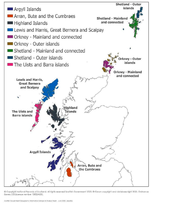
Source: Scottish Government (2023)
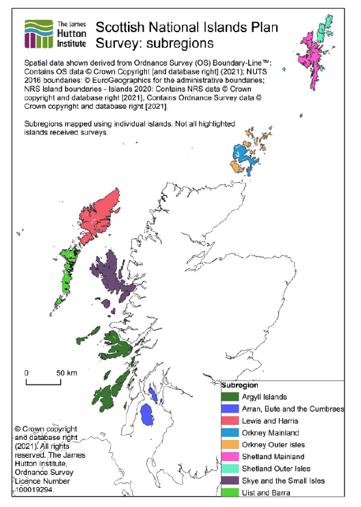
Source: James Hutton Institute (2020)
This has now been updated with the 2023 geography but continues to be used in some sections of the dashboard where updated data is unavailable.