
National Flood Resilience Strategy: implementation report 2021 - 2025
Highlights progress in delivering Scotland’s flood risk management framework between 2021 and 2025. Thirteen flood protection schemes were completed, helping protect around 4,400 properties, while most actions from the first planning cycle were completed or remain on track.
PART A: Progress on specific themes
An Integrated Approach to Flood Risk Management
Flood risk management is the process of assessing, organising and implementing actions to deal with flood risk. Multiple organisations are involved in managing flood risk
The preparation and implementation of flood risk management plans and local flood risk management plans is at the heart of work in Scotland to increase flood resilience. The Act sets out a flood risk management planning process that ensures that long-term and nationally focused objectives are balanced with local knowledge and priorities.
The main outcome of the flood risk management planning process should be a set of sustainable actions being taken to reduce overall flood risk across Scotland.
Flood Risk Management Plans
Scotland is split into 14 areas called Local Plan Districts (LPDs) for flood risk management. Each area has a lead local authority responsible for helping manage flood risks.
For every district, two plans are produced every 6 years:
- A Flood Risk Management Plan (FRMP)
- A Local Flood Risk Management Plan (LFRMP)
Flood Risk Management Plan and Local Flood Risk Management Plan (2016 – 2022)
Section 32 of the Flood Risk Management (Scotland) Act 2009 requires the Scottish Ministers to consider and either approve, modify, or reject the flood risk management plans submitted by SEPA for each flood risk management district. Once approved, the plans must be published and made available to the public, providing the strategic framework that guides flood risk management actions across Scotland.
The first Plans (FRMP1) were published in December 2015, and the first Local Plans (LFRMP1) were published in June 2016, covering the period 2016–2022.
SEPA (the Scottish Environment Protection Agency) prepares the FRMPs, working with other public bodies. These plans set out a long-term strategy for reducing flood risk. They explain:
- The main flood risks in each district.
- The characteristics of local rivers, coastlines and catchments.
- The goals and actions needed in areas most at risk from flooding (known as Potentially Vulnerable Areas).
Local authorities prepare the LFRMP. These plans support the FRMPs by explaining how the agreed actions will be carried out locally and how they will be paid for. Although several councils may work together within a district, one council takes the lead in producing the LFRMP.
Together, the FRMP and LFRMP:
- Set short, medium and long-term goals for managing flood risk.
- Explain what actions will be taken and who will deliver them.
- Help reduce the damage and disruption caused by flooding.
- Take account of climate change and increasing flood risks.
- Aim to make Scotland more resilient to flooding in the future.
Progress on Delivering Flood Risk Management Plan and Local Flood Risk Management Plan (2016 – 2022)
Under Section 38 of the Flood Risk Management (Scotland) Act 2009, Scotland's 14 Lead Local Authorities published reports in December 2022 showing the progress made in delivering the actions set out in their Local Plans, which were first published in 2016. A link to the Reports can be found at Annex C.
The Final Reports present:
- an assessment of the progress made towards implementing the local plans;
- a summary of the planned actions which were not implemented and why; and
- a description of any other actions implemented since the plan was finalised which the lead authority considers have contributed to the achievement of the objective.
The Final Reports show that considerable progress has been made in delivering the actions set out in the Plans and that most actions have been completed with a number ongoing. They also show the co-ordinated and collaborative efforts of public bodies working together to deliver sustainable outcomes.
Flood Protection Schemes Completed (2021-2025)
Twenty one Flood Protection Schemes from LFRMP1 have been completed with 13 completed during the reporting period, providing improved protection to around 4400 properties.
Smithton and Culloden Flood Protection Scheme completed in 2021 The scheme provides protection to 129 properties up to the 1:200-year Standard of Protection. Elements of the scheme have also been designed and constructed to provide an allowance for climate change (29% increase in flows at time of design).
The scheme protects residential properties, as well as a primary school, and some commercial premises within the Smithton and Culloden areas of Inverness from fluvial flooding from the Smithton Burn and the Culloden Burn.
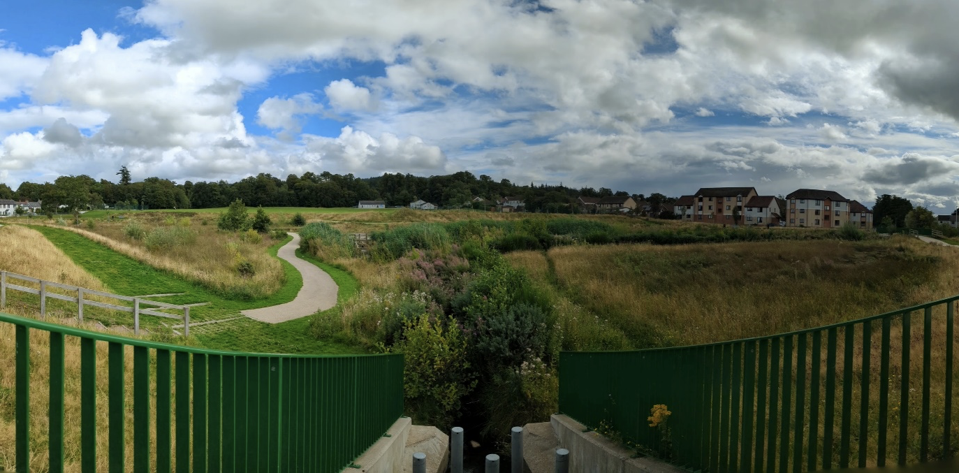
Kirkintilloch Park Burn Flood Protection Scheme; EastDunbartonshire Council completed their actions to minimise flood risk to 70 properties in the Park Burn catchment located in Kirkintilloch. These works involved de-silting and regrading an approximate 500m length of burn, including cleansing of the piped culvert under the Forth and Clyde Canal. Works were completed in two phases in 2021 and 2022 which restores the burn's capacity allowing free flow of surface water through the culverted section under the Forth and Clyde Canal. This provides a higher return period protection and reduces the river water levels thus minimising the likelihood of flooding upstream in the catchment
The Broughty Ferry Coastal Flood Protection Scheme was completed in 2022 and is estimated to protect 450 residential properties, as well as protecting substantial infrastructure.
The Drumnadrochit Flood Protection Scheme was completed in September 2022 and provides protection from fluvial flooding from the River Enrick to 11 residential properties and 24 non-residential properties (including a police station, fire station and shops) in the centre of Drumnadrochit up to the 1:200 year Standard of Protection, with allowance for climate change. The scheme also protects the A831 at Kilmichael from flooding up to the 1:10 year Standard of Protection.
Upper Garnock Flood Protection Scheme was completed in November 2022 by North Ayrshire Council and provides protection to 161 residential and industrial properties. The scheme was designed to reduce the flood risk from the River Garnock, Powgee Burn and Rye Water. The scheme consists of an embankment constructed to form a storage reservoir just north of Kilbirnie which will retain water and reduce downstream flow in the River Garnock, direct defences to protect buildings at the Paddockholm Industrial Estate and the surrounding area in Kilbirnie, properties in the vicinity of the Powgree Burn in Glengarnock and the Mill Park estate in Dalry as well as mitigation measures to the DSM plant and the railway embankment.
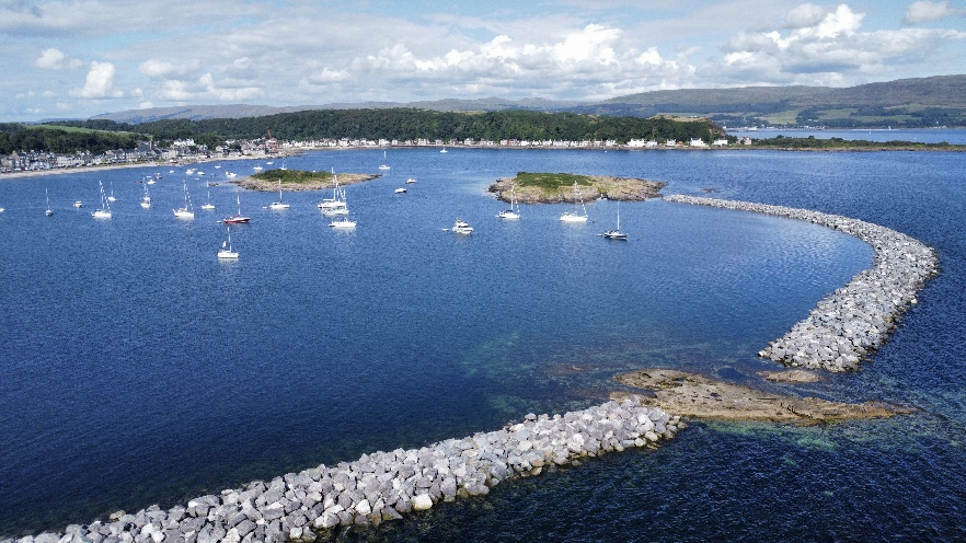
TheMillport Flood Protection Scheme on the Isle of Cumbrae protects 638 properties. It is a £48 million coastal defence project designed to protect Millport from increasing flood risk associated with climate change, rising sea levels and storm events. Construction began in spring 2023 and the scheme was completed in October 2024. The works cover approximately 2 km of Millport’s waterfront and include new flood walls, revetments, breakwaters and associated coastal protection measures. More than 950 precast concrete units and around 142,000 tonnes of armour rock were used to create a robust defence system that protects over 600 properties from coastal flooding while also enhancing the seafront environment. The project was delivered by North Ayrshire Council, with Van Oord UK Ltd and Mackley Civil Engineering as principal contractors.
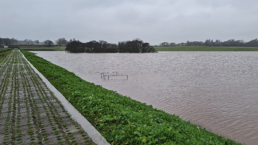
Arbroath (Brothock Water) Flood Protection Scheme was completed in December 2022 by Angus Council provides additional protection to 530 properties and is designed to reduce the risk of flooding from the Brothock Water which runs through Arbroath and provides a one in 200-year standard of protection. The scheme is designed to hold back flows in attenuation areas in the catchment above Arbroath. The design of these areas requires no physical input to allow the attenuation to begin, the flows are constricted at the embankments by culverts, so attenuation begins when flows become greater than the allowable flows. Since completion telemetry monitoring has shown that there have been numerous occasions when the scheme has prevented flooding in Arbroath from the Brothock.
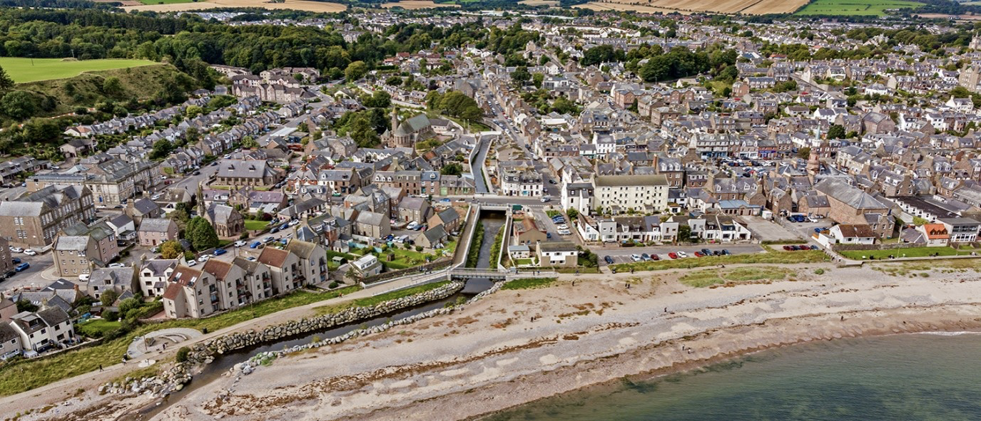
Stonehaven Flood Protection Scheme was completed by Aberdeenshire Council in August 2023. The scheme will reduce the flood risk of 376 residential properties, two public utility sites, a school and an emergency service site from flooding of the River Carron. The level of flood protection provided by the scheme is in excess of the current standard required by the Association of British Insurers.
The works included construction of 2km of flood walls, the installation of two higher capacity culverts and alterations to five bridges - including the refurbishment and reinstatement of the listed White Bridge. The scheme also features innovative self-raising flood barriers, a pump system for surface water flooding and the creation of a large culvert that provides additional capacity during a flood event.
The Caol and Lochyside Flood Protection Scheme which formally opened in August 2023 will provide protection to around 300 homes on the shores of Loch Linnhe. The works, carried out, include a new 1.2km flood embankment along the shores of Loch Linnhe from the Caledonian Canal embankment to the Caol Spit and an 800m flood wall constructed up the side of the River Lochy, adjacent to the road and finishing at Soldier’s Bridge.
The New Cumnock Flood Protection Scheme (phase 2) completed 2022 providing additional protection to 108 properties and held an opening ceremony in April 2023. The scheme involved a combination of engineering measures including 900m of earth embankments, 1200m of reinforced concrete walls and 600m of riverbank strengthening. Prior to work starting on phase two, a major gas main and other utilities within the area had to be diverted, which was a significant project in its own right.
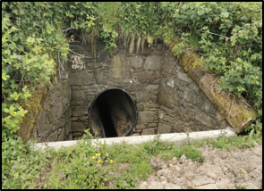
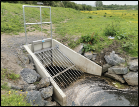
The Stranraer Flood Protection scheme was completed in May 2024 by Dumfries and Galloway Council. The scheme comprises a series of measures designed to provide flood protection to approximately 350 residential and non‑residential properties.
Key elements of the project included the replacement of existing pipework downstream of the A77 culvert. The original pipes crossing the adjacent field were heavily choked and damaged, resulting in overland flows and scouring of the nearby railway embankment. This caused significant ponding within the field during periods of heavy rainfall. The replacement works have addressed these issues and improved conveyance during high‑flow events.
Further improvements were also made to the drainage arrangements downstream of the reservoir. A new 450 mm diameter pipe was installed, alongside a flexible drainage pipe running in parallel to collect runoff from adjacent fields, thereby improving overall drainage performance and reducing flood risk.
The Hawick Flood Protection Scheme was completed in 2025 by Scottish Borders Council. The scheme is one of the largest in Scotland. It has been designed to protect about 1,000 homes from a one-in-75-year event and consists of about two miles (3km) of flood defences and there's also new active travel routes throughout the town.
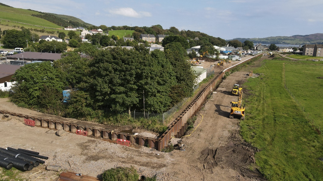
The Campbeltown Flood Protection Scheme was completed in 2025 by Argyle and Bute Council. The scheme was developed to reduce flood risk from small watercourses. The scheme includes temporary storage of flood water on two burns plus a relief culvert in the town to a standard of 1 in 200 years.
Flood Risk Management Plan and Local Flood Risk Management Plan (2022 – 2028)
SEPA is required by law to review and update Scotland's Flood Risk Management (FRM) Plans every six years. The latest plans (FRMP2) were approved, under section 32 of the Flood Risk Management in December 2021 and published in January 2022, following consultation with local authorities, Scottish Water, partner organisations, and the public.
The plans set out Scotland's approach to managing flood risk between 2022 and 2028. They identify high-risk areas, establish long-term objectives, and outline actions to help prevent, prepare for, understand, and reduce flooding. These objectives are based on three key principles: taking a long-term approach that considers climate change, working in partnership with communities and organisations, and managing flood risk across whole catchments and coastlines.
The plans are again supported by Local Flood Risk Management Plans (LFRMP2), which provide more detail on how actions will be delivered locally. Overall, the aim is to reduce the impacts of flooding across Scotland in a way that balances environmental, social, and economic needs.
The main changes[1] in the 2022–2028 Flood Risk Management Plans compared with the 2015 plans are:
- Greater focus on climate change, with more information on how future flood risk has been assessed and how Scotland can adapt to increasing flood impacts.
- Updated objectives and actions, based on progress made since 2015 and improved understanding of flood risk. New actions were added in some areas, while completed actions were removed.
- Stronger emphasis on community involvement, recognising the role communities can play in preparing for and managing flood risk.
- A greater catchment-based approach, looking at flood risk across whole river catchments and coastlines rather than focusing only on individual locations.
- More consideration of natural flood management and blue-green infrastructure, alongside traditional engineering solutions.
- Improved information and transparency, including clearer explanations of how high-risk areas (Potentially Vulnerable Areas) were identified, progress since 2015, and links with land-use planning.
Understanding and Working with Catchments and Coasts
Actions that affect one part of a river, coast or estuary can have consequences elsewhere. This means that flood management actions are most effective when they are planned and coordinated within catchments and along coasts in a way that is uninhibited by administrative boundaries.
Adopting a catchment approach to flood risk management requires an appreciation of catchment and coastal processes, and an understanding of how best to manage the sources and pathways of flood water. This includes looking at how the timing, magnitude and duration of a flood can be managed, e.g. by creating, restoring and enhancing natural features and characteristics of the landscape, including wetlands, woodlands, vegetation, functional flood plains, saltmarshes, beaches and dunes. T[2]cottish National Adaptation Plan[3]and the Scottish Biodiversity Strategy. There have been opportunities [4] funding through the Nature Restoration Fund[5] and Peatland Action which have been deployed in certain locations (like the River Peffery) to reduce downstream flood risk.
Natural Flood Management
Natural Flood Management (NFM) measures reduce, slow or otherwise manage flood waters across catchments and along the coast; they can include salt marsh creation, wetland restoration, floodplain reconnection, woodland planting, leaky dams, and blue-green infrastructure in our urban areas. The Scottish Government, SEPA, Scottish Water, local authorities and other partners continue to work together to deliver NFM measures in Scotland.
In line with their responsibilities under section 20 of the Flood Risk Management Act SEPA produces NFM opportunity maps - a national source of information on opportunity areas for NFM across Scotland. The first maps were produced in 2013 and were most recently reviewed in 2025.
Eddleston Water
The Scottish Government, alongside partners including Tweed Forum and SEPA, continues to support the Eddleston Water project, a long-term research programme exploring the effectiveness of Natural Flood Management (NFM) measures. The project aims to reduce flood risk while restoring the river for local communities and wildlife.
Key milestones include the publication of a second five-year report in 2021, peer-reviewed studies on flood risk reduction and catchment monitoring in 2022, and UNESCO Ecohydrology Demonstration Site status in 2023—the only site of its kind in the UK. The project also received a major Chartered Institute of Ecology and Environmental Management award in 2023.
Evidence from the project shows that NFM can delay flood peaks, provide environmental benefits, and help address climate change impacts, although its ability to reduce flooding is more limited during extreme events. More information is available from The Eddleston Water Project – Tweed Forum
Allan Water
The Scottish Government also continued to support the Allan Water Improvement Project run by Forth Rivers Trust, which works with landowners to engage sustainable land management in the Allan Water catchment with an aim of using nature to benefit rivers. The work includes a range of nature-based solutions to help slow the flow of water to aid in the fight against flooding, keeping rivers cool from increasing temperatures via riparian tree planting, restoring degraded peatland locking in carbon, installing new wetlands to help capture flows and boost wading bird populations.
From April 2022, Forth Rivers Trust was part of the MERLIN project. This project, funded through the EU, aims to restore freshwater and peatland habitats on a European scale, seeking to combat the widespread loss of habitat and the effects of climate change. The Forth catchment is one of 17 case studies across Europe.
In 2024 the Allan Water Improvement Project won the Climate Impact category in the Scottish Council for Voluntary Organisations (SCOV) Scottish Charity Award 2024. More information is available here: Allan Water Project | Forth Rivers Trust
The NFM Network
The NFM Network Scotland online resource has continued to bring together practitioners, researchers and communities to share knowledge, best practice and experience of implementing NFM.
CIRIA Natural Flood Management Guidance
For natural flood management to have any significant impact, schemes need to be technically robust. The Construction Industry Research and Information Association (CIRIA) published a good practice guidance for the delivery of NFM in 2022. This guidance presents case studies, develop a design philosophy, and design criteria to ensure the right outcomes are delivered. The guidance also signposts how designing for multiple benefits can unlock different funding sources. SEPA part funded the work.
Coastal Change Adaptation
Coastal erosion is affecting more of our erodible shore than before, with the extent and rate of erosion anticipated to increase under all emission scenarios due to sea level rise. To reduce the impact of coastal erosion due to sea level rise, our coast and its assets and communities need to build resilience and implement adaptation planning.
The Dynamic Coast project, funded by Scottish Government, delivers the mapping and data to allow us to adapt to the challenges that climate change presents. It aims to provide the strategic evidence base on the extent of coastal erosion in Scotland by improving the evidence on coastal change; improving the awareness of coastal change; and supporting decision-makers to ensure Scotland’s coast and assets can adapt to our future climate. The evidence base provided is available to support authorities and communities plan and adapt to climate change impacts on our coast. The main resources and reports for Dynamic Coast 2, including maps highlighting coastal erosion are available on the Dynamic Coast website.
Scottish Government’s Coastal Change Adaptation Fund provided almost £12 million in funding to local authorities from 2022/23 to 2025/26 to support Local Authorities plan and implement coastal adaptation. As part of this funding package, the Scottish Government distributed almost £8 million to local authorities with erodible shorelines and almost £3 million to support the development of local case studies. As well as the direct funding of local authorities, in 2025 the Scottish Government also invested £650,000 to enable the capturing of LiDAR data covering almost 800 km² of Scotland’s coastline.
Engaging With the Public
Public awareness, participation and community engagement are essential components of sustainable, long-term flood risk management. Public participation can raise awareness of how flood risk is evolving as our climate changes, inform decisions that contribute to the successful implementation of actions and ensure that the public know what actions they can take themselves at the household and community level.
Land and property owners are primarily responsible for protecting their properties from flooding. Individuals, businesses and communities play an important local role in flood management by acting as their own first line of response to building flood resilience. These actions can play an important role in complementing and supporting the work undertaken by SEPA and the responsible authorities.
The Scottish Government, SEPA, local authorities and other partners support a number of initiatives that help to improve community engagement and increase community resilience.
There is already a wide range of guidance available to help households, communities and businesses build resilience to climate change and flooding. SEPA provides flood maps, live flood warnings, flood forecasting and its Floodline service, helping people and organisations understand their flood risk and prepare for flood events (SEPA; Flood Risk Management Plans). Alongside this, Ready Scotland offers practical advice for households on preparing for flooding, emergency planning and property protection measures (Ready Scotland – Flooding).
Adaptation Scotland is Scotland's climate adaptation advice hub, providing tools, guidance and case studies for public bodies, businesses, communities and households to prepare for climate impacts such as flooding (Adaptation Scotland).
For communities, the Community Climate Adaptation Routemap provides a practical framework for understanding local climate risks and identifying actions to strengthen resilience (Community Climate Adaptation Routemap).
For businesses, Adaptation Scotland's Building Business Resilience resources and SME resilience tools help organisations assess risks to premises, people, products and supply chains and take practical adaptation actions (Businesses – Adaptation Scotland).
Additional flood resilience guidance, including advice on property-level protection measures and recovery from flooding, is available through the Scottish Flood Forum (Preparing for Flooding)
Finally, whilst not specifically highlighted here, local authorities engage with communities through a wide variety of local initiatives, as well as direct engagement as part of delivering the objectives and actions set out in the Local Plans.
Scottish Flood Forum
The Scottish Flood Forum (SFF) is an independent charity that provides practical support to individuals and communities affected by flooding, alongside advice and assistance to improve flood preparedness and resilience. The Scottish Government has provided grant funding to the Forum since 2009, recognising its unique role in supporting communities before, during and after flood events.
Demand for the services has continued to grow during a period of increasingly frequent and severe flooding.
The Forum provides three core types of support:
- Flood recovery advice, including practical guidance on drying and cleaning properties, navigating insurance claims and securing cover;
- Property‑level flood resilience advice, helping homeowners understand options to reduce water ingress and speed recovery;
- Community resilience support, including the establishment and development of community flood groups, flood action planning and the deployment of local resilience measures.
Recovery can be prolonged and complex, particularly for vulnerable households, and the Forum continues to provide sustained support well beyond the immediate response phase. This approach was particularly evident following flooding in Dumfries and Galloway in 2022 and in Angus during the severe storms of 2023, including Storm Babet.
The Forum also provides limited practical assistance, such as the loan of dehumidifiers to vulnerable households, and plays an important role in signposting practical and financial support.
Supporting Community Flood Action Groups
The Scottish Flood Forum works closely with community flood action and resilience groups across Scotland. These groups vary in size, maturity and function, ranging from newly established organisations to long‑standing groups that provide flood wardens, coordinate local response, engage in consultations, and advocate for affected residents.
Support provided includes advice on setting up groups, developing flood action plans, accessing funding for resilience equipment, training volunteers, and facilitating peer to peer learning. The Forum has supported communities across a wide range of urban and rural areas, including Orkney, Aberdeenshire, Angus, Perth and Kinross, Glasgow, Fife, South Lanarkshire, Ayrshire and Dumfries and Galloway.
Peer learning events provide opportunities for community representatives to share experience, good practice and emerging initiatives. This includes engagement on insurance led recovery initiatives designed to support more resilient repairs following flooding.
Property Level and Community Resilience
The Forum continues to play a key role in promoting property-level flood resilience, providing trusted, independent advice as demand for household flood protection assessments grows.
To boost awareness, funding was secured for a new mobile flood resilience vehicle, Flo, which launched in early 2025. This initiative delivers practical demonstrations and expert guidance to communities across Scotland, helping people make informed decisions about flood protection.
The Forum has also installed community flood alerting systems at several locations, with more in development. These systems provide early warnings and proved highly effective during recent severe weather events.
Following flooding incidents, the Forum works with communities to update flood action plans, ensuring continued learning and stronger local resilience
Community Flooding Volunteers
From 2021 to 2025 the Scottish Government continued to financially support The Conservation Volunteers Scotland (TCVS). TCVS bring a citizen science approach to local community groups to develop activities that help manage flood risk in their area. TCVS is working with Clackmannanshire Council, Stirling Council and SFF to deliver the Citizen Science Community Monitoring project. These projects help raise awareness of flood risk and get local communities involved in recording useful information about local burns.
In Clackmannanshire, TCVS provides training, guidance and support for volunteers and the Council has selected three burns for volunteers to monitor river levels, sediment chokes and blockages from key vantage points. Through the project local communities and volunteers are actively recording data and strengthening their resilience to floods.
Promoting Flood Resilient Properties
Flood Re is a UK wide flood reinsurance scheme that ensures that flood insurance remains affordable to those who need it. Stakeholders from across Scotland have worked with the insurance industry to help develop the scheme to ensure the voices of Scotland's communities at risk of flooding are heard. Flood Re was launched in April 2016 and set to be in place until 2039. As of March 2026, Flood Re has benefited more than 9,000 properties in Scotland.
Those benefiting from Flood Re should be aware of their flood risk and, where possible and appropriate, consider installation of property flood resilience measures. Build Back Better (BBB) is a Flood Re initiative that helps homeowners make their properties more flood-resilient after a flood, rather than simply restoring them to their previous condition. Build Back Better supports reimbursement (up to £10,000), over and above work to repair damage and loss caused by a flood, of costs associated with building back improved flood resilience as part of a flood claim
Property Flood Resilience Delivery Group and Action Plan.
Property flood resilience measures are an essential and cost-effective part of a sustainable and proactive approach to flood risk management. However, these measures are not being taken up as widely as they could be in Scotland.
With evidence to support the physical and emotional impacts of living in temporary accommodation after a flood event, the Scottish Government set up the Property Flood Resilience Delivery Group (PFRDG) in 2019 to discuss what support home and business owners might need to make their properties flood resilient. The PFRDG brings together a range of stakeholders from across the public and private sector to work together to ensure that Scotland is better prepared for flood events. Members include Flood Re, the Association of British Insurers and the Scottish Flood Forum.
The Scottish Government recognises the importance of flood resilience and in the 2019 Programme for Government included a commitment to publish an action plan to promote and support property flood resilience actions. The PFRDG produced the action plan in 2019, which recommends actions to help promote the use of property flood resilience measures within Scotland.
In the intervening years the PFRDG has performed well against the action plan. Of the 6 objectives highlighted in the plan a number have been completed and are underway. An example is the updated guidance for Building Standard 3.3 – Flooding and Groundwater. After 2 years of work a new document based on PAN69 (Planning and Building Standards Advice on Flooding) has been created. These now reference and refer to Property Flood Resilience (PFR) measures. A road test of the guidance is underway with the Building Standards Hub (which includes local authorities).
The Chartered Institution of Water and Environmental Management community of practice website which aims to provide professional audiences across the UK with a one stop shop for PFR information became live in 2021. The PFRDG continue to track any issues through input from key sectors and members of the group such as availability of PFR products, supply chain and trained installers which shows that we are still in the early stages of having a mature market in place to offer PFR to homeowners in a consistent and confident manner.
Since 2025 the PFRDG has sat under the implementation group for the Flood Resilience Strategy and continues to build on the action plan from 2019 by identifying and developing new actions to take forward.
Contact
Email: Flooding_Mailbox@gov.scot