Scottish Agricultural Census: final results - June 2020
Final results from the 2020 June Agricultural Census on land use, crop areas, livestock and the number of people working on agricultural holdings. These results replace the provisional figures published on 6 October 2020.
Part of
Most of Scotland's area is used for agriculture
Agricultural area
5.64 million hectares
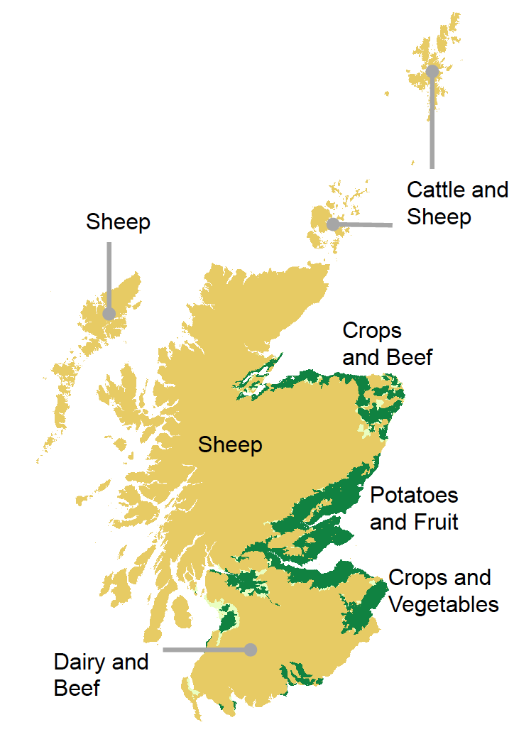
This map shows the main farming types found in each area.
Orange areas have limited growing conditions, usually hilly or rocky land suitable for livestock.
Light green areas have better soil and can support crops usually grown for animal feed.
Dark green areas can support vegetables, fruit and cereal farming for human consumption.
Hectares (ha) is the land measurement used in agriculture. One hectare, or 10,000 square metres, is roughly the full size of a rugby pitch.
Ten-year averages are used to compare current values to values over the past ten years (2010-2019).
All numbers in this publication are rounded numbers. At times, rounded numbers may not add up to the rounded total.
Contact
Email: agric.stats@gov.scot