Regional Land Use Partnerships: phase 1 process evaluation - final report

The Regional Land Use Partnerships (RLUPs) evaluation report considers the lessons learned from the Year 1 (2021 to 2022) pilot process. The report was completed by SAC Consulting and outlines key early findings from RLUP pilot establishment.


Appendix A: Pilot region overviews

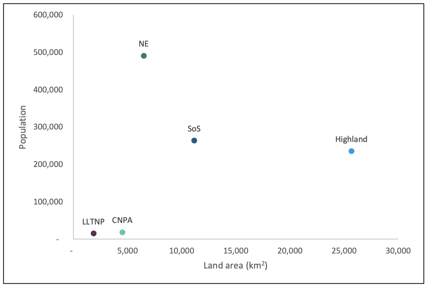
This section gives some further context on the five pilot regions that are currently running, 2020-2023. While the body of this report focused on the pilot process overall and aggregated the results of the individual pilots to draw out common issues and potential solutions, this section gives some insight into the wide differences between these regions.

Figure A1: Map of the pilot regions. These five regions cover a large part of Scotland’s land area and encompass a wide diversity of Scottish landscapes, land uses and human lifeways. Provided by SG RLUP policy team via Knowledge Hub.
Map of Scotland showing the colour coded pilot regions, including the Highland Region, Cairngorms National Park, The North East Region, Loch Lomond and Trossachs National Park and The South of Scotland Region.

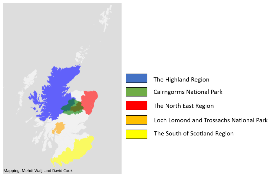
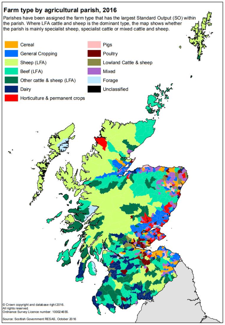
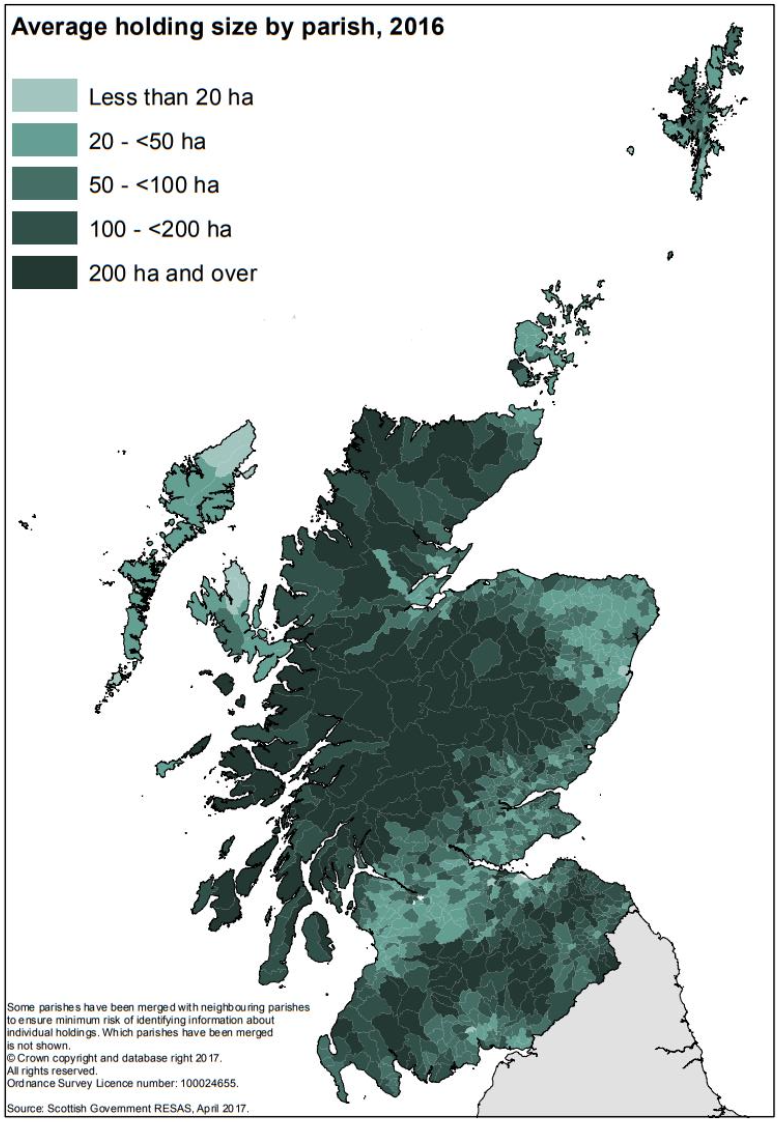
These five regions each expressed an interest in being an RLUP pilot and were accepted. These regions contain a diversity of landscapes and land uses, including urban, peri-urban, arable, upland, peatland and forestry[9] (see Figure A1). Each region also has a different composition of social groupings and institutions including communities, enterprises, and partnerships across Scotland (see Figure A2). This diversity is an essential asset to the pilot process, as the unique barriers and enablers encountered within each landscape should drive innovative solutions which offer insights for the future of the RLUP policy.

Figure A2: RLUP pilot regions, land area vs. population. This plot shows the wide difference in size, population, and therefore population density between the five RLUP pilots, one of the major variables requiring adaptation. The national parks are smaller than the other RSS regions and have very low populations within their boundaries. The Northeast region is not much larger than the Cairngorms, but has the highest population, about half of which is due to the inclusion of Aberdeen City Council area. South of Scotland is both large and populous. Highland Region is a massive land area with similar population to SoS, although for their RLUP pilot they narrowed to the NW2045 region, which is similar in size and population to the national parks.
Scatter plot showing each RLUP pilot region plotted by land area on x-axis and population on y-axis.  The national parks are plotted in lower left quarter and North East and South of Scotland regions are in upper left quarter. Highland Region is in lower right quarter.
Figure A3 & A4: Farm type and average holding size by parish, 2016, from Scottish Government. [10] These maps provide further context to the differences in land use between the different pilot regions.
Map of Scotland showing colour coding of areas based on Farm type. Sheep dominates the Highlands region, some islands, north of Scotland and hill areas. Dairy and Beef dominate lowland Scotland, particularly Ayrshire and Wigtonshire.  The east of Scotland has significantly more arable cropping. Map of Scotland showing average holding size by parish in 2016. Larger estates (>200 ha) located across Highlands and the north of Scotland. Also notable in South of Scotland. The central belt and some of Aberdeenshire is dominated by smaller farms (<100 ha).

Contact

Email: regionallandusepartnerships@gov.scot

Back to top