Proposal to designate Red Rocks and Longay as a Marine Protected Area: consultation
An overview of the consultation to designate a new Marine Protected Area within the Inner Sound of Skye, including short summaries of the available documentation. The MPA will protect flapper skate and their eggs as well as the geodiversity feature, Quaternary of Scotland.
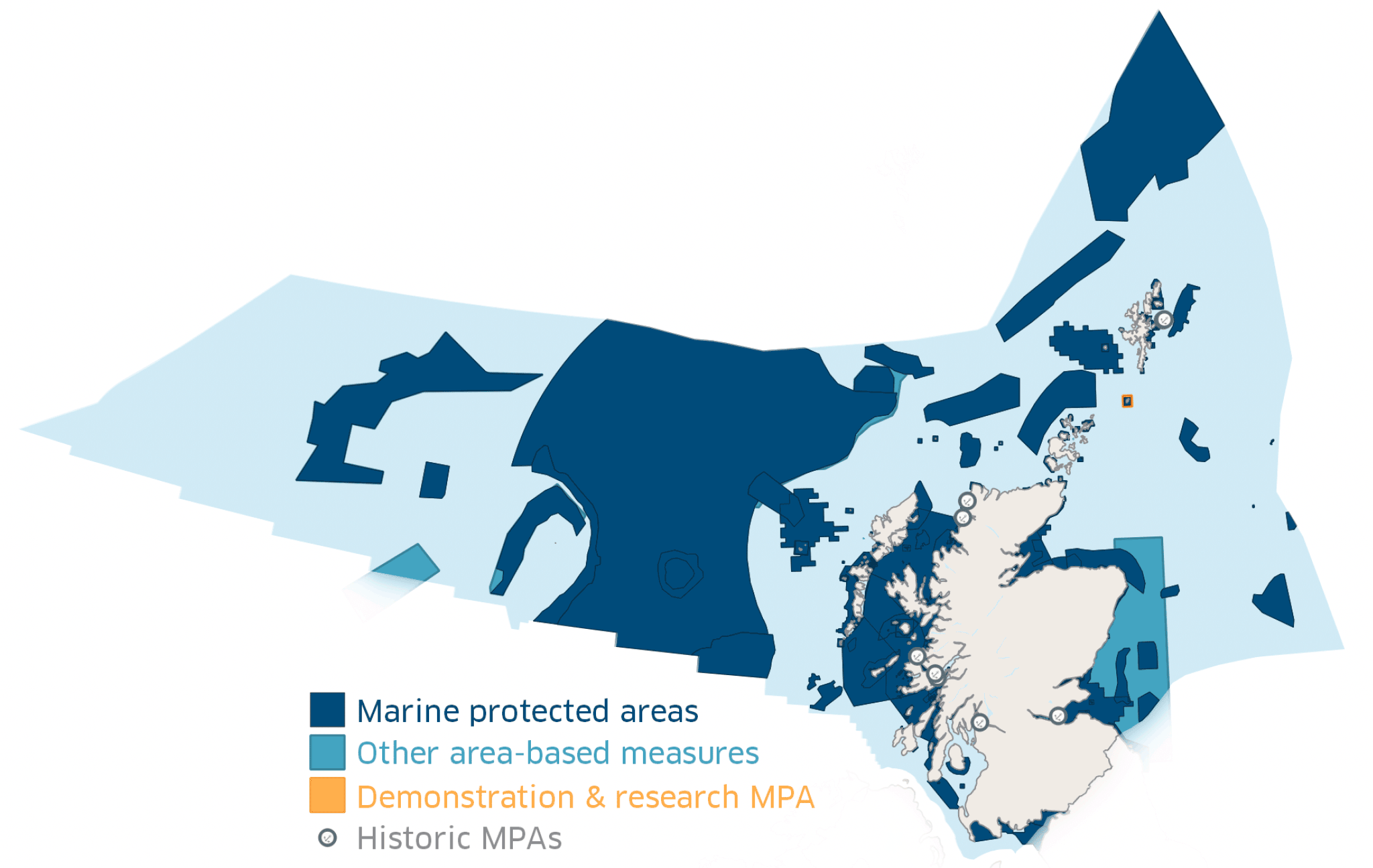
Scotland's Marine Protected Area (MPA) network
The seas around Scotland and the spectacular wildlife they support are one of our best kept secrets, one that only a very few have had the privilege to explore first hand, but upon which we all depend for our quality of life.
Our seas account for 61% of UK waters and remain at the forefront of our food and energy needs, through fishing, aquaculture, oil and gas, and new industries such as renewable energy, as well as recreation activities and eco-tourism.
Scotland's MPA network is being developed to help safeguard our most important natural and cultural heritage features on the principle of sustainable use. By doing so we are protecting the natural goods and services they provide for current and future generations to enjoy.
The MPA network, as shown in Figure 1, consists of sites designated for nature conservation. In addition to MPAs the network includes areas that: provide nature conservation benefits (called Other Area Based Measures), protect the historic environment (Historic MPAs), and areas for demonstrating or researching marine management (Demonstration and Research MPAs). The network currently consists of 245 sites which protect 37% of our seas.
Scottish Ministers have national and international commitments to create a network of MPAs which:
- Contributes to conservation or improvement of the marine environment;
- Represents a range of features present in Scottish waters; and
- Reflects that the conservation of a feature may require the designation of more than one MPA.
Contains information from the Scottish Government (Marine Scotland), NatureScot, and Historic Environment Scotland licensed under the Open Government Licence v3.0.
Contact
Email: marine_conservation@gov.scot