Developing a method to estimate the costs of soil erosion in high-risk Scottish catchments: final report
Report from a project which developed and used an ecosystem service framework approach to estimate the costs of soil erosion in Scotland, for five study catchments.
4. Soil erosion rates and probabilities
In order to evaluate the economic consequences (impacts and costs) of soil erosion in the selected catchments (followed by national scale analysis), it is first necessary to identify the rates at which soil erosion is likely to occur and then the probability of such an event occurring.
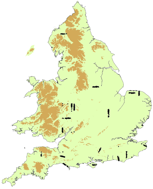
However, despite the comprehensive search of the literature, data on soil erosion rates and the probability of erosion in any one year specifically in Scotland is limited. However, mapping of Erosion Risk Classes has covered an extensive area of Scotland.
4.1. Soil erosion rates
It was decided to create a ‘look up’ table that assigned a representative soil erosion rate (t ha-1 yr-1) to the Erosion Risk Classes identified by Lilly et al. (2002) and Lilly and Baggaley (2014). Due to the large number of possible land use / Erosion Risk Class combinations, it was necessary to simplify the 9 classes for mineral soils and 8 classes for organo-mineral and peat soils. It was decided to have 3 classes (High, Moderate and Low) for the mineral soils and one class for the organo-mineral and peat soils. The Risk Classes had originally been based on soil texture, slope and hydrology class, but did not include land use. Although there are many different land uses in the catchments (and nationally), given the time available to run the analysis, it was necessary to simplify land use into 9 categories (Horticulture; Arable intensive; Arable extensive; Grassland improved; Grassland unimproved; Rough grassland; Forestry; Woodland; and Wildscape). The ‘look up table’ would include all of these factors affecting erosion, providing a more detailed estimate of soil erosion rates within the catchments than available before. Each cell would have have a representative soil erosion rate (t ha-1 yr-1), although some cells may be redundant or unlikely to occur.
Although it was possible to map soil erosion observations to Erosion Risk Classes, many of these are qualitative and very few have quantified rates of soil erosion. Where data on rates did exist, these locations were georeferenced to assign an Erosion Risk Class to that location (with its associated soil erosion rate). We approached Dr Bob Evans for original data from his field surveys of soil erosion rates in Scotland in the 1980s (Watson and Evans, 2007), that could also be georeferenced and assigned an Erosion Risk Class. However, unfortunately, this data was no longer accessible.
4.1.1. Exploring the relationship between Erosion Risk Class and observed soil erosion rates (mineral soils)
Given the lack of a comprehensive dataset of quantified erosion rates in Scotland (see Literature Review), it was agreed that the most extensive field observation dataset in the UK would be used to assign erosion rates to each of the Erosion Risk Classes for any given land use (Evans, pers.comm., 31/07/19). The “National Erosion Survey” of the mid 1980s is still the best empirical data source for erosion for reasons outlined in Evans (2005). The survey was concerned with monitoring rill erosion occurrence and magnitude, based on field assessment provided by Dr. Evans. The original fieldwork made over 1,680 field observations of erosion and deposition in England and Wales between 1982-86. This dataset recorded the site location, year, erosion volume (m3), field area (ha), slope gradient (including maximum slope gradient), volume of deposition (m3), location of erosion / deposition, land use and soil type (Figure 7). Notes about the sites were also recorded. The method for converting the volumetric measurements into annual erosion rates (t ha-1 yr-1) is described in Defra SP1318 (Rickson et al., 2016). The method for classifying the land uses into those used in the ‘look up’ table is given in Appendix 2. As it is not possible to analyse every crop individually in the economic model, this is basically a simplification of the land into different categories depending on the way the soil is managed and disturbed.
Each site was georeferenced to obtain slope, topsoil texture and HOST class. This allowed each site and its observed erosion rate to be assigned an Erosion Risk Class. The risk class can then be derived on a field by field basis by applying the rule base shown in Table 4.
| Standard percentage runoff (%) | Texture | 0 - 2° | 2 - 5° | Slope 5 - 10° |
10 - 18° | 18 - 30° |
|---|---|---|---|---|---|---|
| 0 - 20 | Fine | L | L | L | M | M |
| Medium | L | L | M | M | M | |
| Coarse | L | M | M | M | H | |
| Organic | L | L | L | M | M | |
| 20 - 40 | Fine | L | L | M | M | M |
| Medium | L | M | M | M | H | |
| Coarse | M | M | M | H | H | |
| Organic | L | L | M | M | M | |
| 40 - 100 | Fine | L | M | M | M | H |
| Medium | M | M | M | H | H | |
| Coarse | M | M | H | H | H | |
| Organic | L | M | M | M | M | |
| Peat | H | H | H | H | H | |
All the observed soil erosion data was classified into Erosion Risk Classes, using the Lilly and Baggaley (2014) model. As quite a few of the sites had no direct erosion data, the measured volume of deposition was taken instead. This gave around 1,700 data points. The calculated soil erosion rate results are shown in Table 5. It is noticeable that these observed soil erosion rates are lower than those observed in Scotland (see Literature Review), but this is probably because most of the Scottish data were collected in response to dramatic erosion events.
Initial evaluation of the data focussed on whether observed soil erosion rates reflected the corresponding Soil Erosion Risk Classes of Low, Moderate and High for that location. This was expected as the Risk Classes reflect the soil susceptibility to particle detachment (soil texture), the amount of overland flow likely to be generated (from HOST-SPR) and the velocity of that flow (based on slope gradient). However, this progression was only seen in the Extensive Arable class (Table 5).
Within the land use classes, Improved Grassland gave higher soil erosion rates for the Moderate Erosion Risk Class (6.2 t ha-1 yr-1) compared to the High Risk Class (4.672 t ha-1 yr-1). Only Intensive Arable in the High Erosion Risk class had a higher erosion rate (i.e. 8.44 t ha-1 yr-1). The relatively very high rates of erosion in the Improved Grassland could be explained by the fact that many of Evans’ Improved Grassland sites were on reseeded grass leys, where a fine seedbed and the lack of a protective cover of surface vegetation and dense root network are likely to have generated high rates of erosion.
Equally, calculating average erosion rates from the Evans’ data solely by Risk Class also failed to provide a progression of increasing rates, as Risk Class increased from Low to Moderate to High, with land at Low risk having an annual average soil loss of 3.442 t ha-1 , land at Moderate risk having an annual average soil loss of 3.074 t ha-1 and land in the High risk class having an annual average soil loss of 4.317 t ha-1 .
These results were not unexpected as the Erosion Risk classes developed for Scotland are based on the inherent risk without consideration of land use (Lilly et al., 2002 & Lilly and Baggaley, 2014). However, recent work on soil erosion in Scotland showed the role that land use plays in both mitigating and exacerbating soil erosion (Baggaley, Lilly and Riach, 2017; Lilly et al., 2018 and Baggaley et al., 2017 ). Thus, it was decided to accept that soil erosion rates should be largely driven by land use, but the probability of erosion happening should be largely driven by Erosion Risk class. The adoption of this approach underpins the assessment of the annual cost of erosion in Scotland.
| Land use | Mineral soils | ||
|---|---|---|---|
| Low | Moderate | High | |
| Horticulture | 3.131 | 4.248 | 2.625 |
| Intensive arable | 4.131 | 3.511 | 8.44 |
| Extensive arable | 2.101 | 2.304 | 2.385 |
| Improved grassland | 2.826 | 6.204 | 4.672 |
| Unimproved grassland | No data | No data | No data |
| Rough grassland | No data | No data | No data |
| Forestry | No data | No data | No data |
Thus a mean rate of erosion (t ha-1 yr-1) associated with the broad land use classes was calculated, based on the Evans data, where available (Table 6).
| Land use | Mean soil erosion rate (t ha-1 yr-1) |
|---|---|
| Horticulture | 3.835 |
| Intensive arable | 4.314 |
| Extensive arable | 2.389 |
| Improved grassland | 5.228 (3**) |
| Unimproved grassland | No data available |
| Rough grassland | No data available |
| Forestry | 0.593* |
| Woodland | 0.593* |
| Wildscape | 0.593* |
*Based on rates cited in the Literature Review. ** See text for explanation
It was agreed that the rate of erosion for Improved Grassland (5.228 t ha-1 yr-1) is likely to be an overestimate, due to the inclusion of erosion events on highly erodible reseeded grass leys. The value was later revised to 3 t ha-1 yr-1, based on: Scottish data in the Literature Review (although there were few data points: the values ranged from 0.86 to 5 t ha-1 yr-1 with a mean of 3 t ha-1 yr-1) and using other empirical observations which had a range of 0.36 to 4.49 t ha-1 yr-1 (Graves et al., 2011). Using the limited data from Scotland for ‘sense checking’, the erosion rate for Extensive Arable was 9.55 t ha-1 yr-1 (n=37) and 7.47 t ha-1 yr-1 for Intensive Arable (n=5) after the removal from the data of an exceptionally high rate of erosion of 345 t ha-1 from a potato field.
4.1.2. Exploring the relationship between Erosion Risk Class and observed soil erosion rates (organo-mineral and peat soils)
Soil erosion rates for organo-mineral (soils with a peaty surface layer) and peat soils under Forestry and Moorland were found in the Literature Review (0.13 - 0.25 and 0.3 - 0.39 t ha1 yr-1 respectively). However, few studies exist of equivalent erosion rates for horticulture; intensive arable; extensive arable; or improved grassland on these soil types (assuming this soil type / land use combination exists). The rates (15 t ha-1 yr-1) used in Graves et al. (2011) for England and Wales were based on expert judgment. The consensus in the current project is that this seems too high, especially given the low bulk densities (typically 0.16 Mg m3) which would produce massive volumes of eroded soil (and incur significant loss of soil depth, which is important for the modelling of yield losses in the economic model to calculate annual costs of erosion - see Section 6 below).
Other datasets were explored. The National Monitoring Scheme (Evans, 2005) only had 1 site on peatland. Other studies on peat erosion rates (e.g. McHugh (2000)) refer only to uncultivated, upland areas. Accurate soil erosion rates on peat are also difficult to separate from soil losses due to oxidation, shrinkage, drainage and erosion by wind. No studies quantify rates of erosion by water alone (the focus of the current project). In any case, most peat soil is under woodland, moorland or rough grazing (or Grouse moor), so it was assumed that the area of peaty soils under arable production will be limited for the case study catchments. The estimated rates of soil erosion for organo-mineral and peat soils are given in Table 7.
| Land use | Peat erosion rate (t ha-1 yr-1) (from E&W; Graves et al. (2011)) | Erosion rate (t ha-1 yr-1) for organo-mineral soils and peats (proposed for Scotland) |
|---|---|---|
| Horticulture | 15 | 7 |
| Arable intensive | 20 | 10 |
| Arable extensive | 10 | 5 |
| Grassland improved | 7 | 1 |
| Moorland | - | 0.39* |
| Forest | - | 0.13* |
*From the Literature Review Appendix 1. Literature Review
4.2. Final erosion rates by land use and Erosion Risk Class
The finalised soil erosion rates (t ha-1 yr-1) per land use and Soil Erosion Risk Class are shown in Table 8.
| Land use | Mineral soils | Organo-mineral and peat soils |
|---|---|---|
| Horticulture | 3.8 | 7 |
| Arable intensive | 4.3 | 10 |
| Arable extensive | 2.4 | 5 |
| Grassland improved | 3.0 | 1 |
| Grassland unimproved | 2.07 | 0.39 |
| Rough grassland | 0.75 | 0.39 |
| Forestry | 0.6 | 0.13 |
| Woodland | 0.6 | 0.13 |
| Wildscape | 0.6 | 0.13 |
4.3. The probability of soil erosion in space and time
Having estimated the likely erosion rate for a given land use, it is recognised that not all fields in a catchment under a certain land use will erode every year. The rates will be modified by the proportion of that land use actually incurring soil erosion in any one year. Some work on this is reported in the Literature Review. For example, based on field observations, the probability of erosion occurring in cropped fields in England and Wales was presented by Evans (2005) (Table 9).
| Occurrence of erosion | Risk of occurrence of erosion | ||
|---|---|---|---|
| crop type | % | crop type | Risk |
| Winter cereal | 42.8 | Winter cereal | 1 in 42 |
| Sugar beet | 18.4 | Sugar beet | 1 in 7 |
| Spring cereal | 11.5 | Spring cereal | 1 in 34 |
| Potatoes | 10.6 | Potatoes | 1 in 10 |
| Field vegetables | 6.3 | Field vegetables | 1 in 14 |
| Other | 3.0 | Other | 1 in 11 |
| Maize | 1.6 | Maize | 1 in 7 |
| Bare soil | 1.5 | Bare soil | 1 in 21 |
| Oilseed rape | 1.5 | Oilseed rape | 1 in 100 |
| Peas | 1.0 | Peas | 1 in 38 |
| Kale | 0.7 | Kale | 1 in 24 |
| Hops | 0.5 | Hops | 1 in 6 |
| Field beans | 0.4 | Field beans | 1 in 71 |
| Ley grasses | 0.2 | Ley grasses | 1 in 32 |
Based on these observations, Graves et al. (2011) used the following probabilities of soil erosion occurrence for different land uses:
- Grassland 5%
- Rough grazing 2%
- Forestry 1%
- Woodland 1%
- Intensive arable and horticulture 17%
For the purposes of the present project (and rather than taking probabilities from the Evans’ dataset; Table 9), it was assumed that the Erosion Risk Classes (related to soil type, slope and runoff potential) reflect the differences in probability of erosion occurring (i.e. the proportion of fields likely to erode in a year). To validate this approach, two studies were used, which undertook systematic studies of soil erosion, where all fields were surveyed, and the presence or absence of erosion at the time of survey was recorded. In Strath Earn, data presented by Davidson and Harrison (1995) was analysed and showed that as the inherent vulnerability (i.e. Erosion Risk Class) increases in each of the fields, so the probability of erosion also increases, both when analysed for all 9 Erosion Risk Classes and for the aggregated risk classes (Table 10).
| Risk Class | Number of eroded fields | Total number of fields | Percentage eroded |
|---|---|---|---|
| H | 30 | 75 | 40 |
| M | 45 | 204 | 22 |
| L | 0 | 3 | 0 |
Using transects in the Ugie and South Esk catchments (Baggaley, Lilly and Riach, 2017), analysis again shows evidence that the probability of erosion increases with Soil Erosion Risk Class (Table 11).
| Risk class | Number of eroded fields | Total number of fields | Percentage eroded |
|---|---|---|---|
| High | 2 | 27 | 7 |
| Moderate | 15 | 372 | 4 |
| Low | 0 | 28 | 0 |
The difference in the absolute values is probably due to different climatic conditions. However, using the mean of these 2 studies gives the probabilities of erosion as:
- Low Erosion Risk Class: 0% (with a nominal value of 2%, recognising that some erosion may occur very occasionally)
- Moderate Erosion Risk Class: 13%
- High Erosion Risk Class: 24% (Table 12).
These values correspond well with those from other Scottish researchers who have reported the % of arable land affected by soil erosion at any one time (and compared to the 17% reported in Evans’ work for England and Wales). Namely:
- Kirbride and Reeve (1993) 27%;
- Wade: 25.5%;
- Davidson and Harrison (1995): 26.76%
- Watson and Evans (2007): 11.6%;
- Baggaley et al. (2017): 0.36 - 10%
Additional supporting evidence that the probability of soil erosion increases with Erosion Risk Class comes from an analysis of all the data on erosion observations in Scotland (Figure 3). The Risk Class was determined for each field where erosion had been recorded, then compared to the proportional area of the Risk classes within the cultivated land covered by the erosion risk map. The results showed that the proportion of eroded fields was approximately equal to the proportion of land at moderate risk and the proportions of eroded fields was greater than the proportion of the land area in the High Risk Class and less than for land in the Low Risk Class.
For organo-mineral (soils with a peaty surface layer), humic and peat soils, the ‘average’ probability of erosion incidence was calculated from the National Soil Inventory of Scotland (NSIS) 1978-88 dataset (Lilly et al., 2010). This dataset has observation on soil erosion on a 5km grid throughout Scotland. The probability for peat erosion (based on observed erosion on peat soils) was 31% (Towers et al., 2006). The equivalent for the organo-mineral soils was calculated as 12.1%. These figures represent national assessments by soil type and by the proportion of occurrence of these soils in Scotland. As only one combined ‘peaty soils’ class has been used in the current project, the occurrence of erosion on all peats (n = 695) and peaty and humic soils (n = 854) was calculated from the NSIS data to be 21% (Table 12). This will be applied consistently for each catchment and at the national scale.
| Area at risk (%) | |||
|---|---|---|---|
| Erosion Risk Class | |||
| Low | Moderate | High | Organo-mineral soils and peat |
| 2% | 13% | 24% | 21% |
In summary, the rates of erosion were calculated from Evans data from England and Wales for broad land use classes. The probability of soil erosion occurring was calculated from Scottish data for each of the mineral Soil Erosion Risk Classes (Low, Moderate and High) and an overall probability calculated for all organo-mineral and peat soils combined. The combination of soil erosion rate and soil erosion probability will allow the determination of potential annual soil losses and allow the cost of soil erosion in Scotland to be calculated.
Contact
Email: resasadmin@gov.scot
There is a problem
Thanks for your feedback