Agglomerations Noise Action Plan for Scotland:
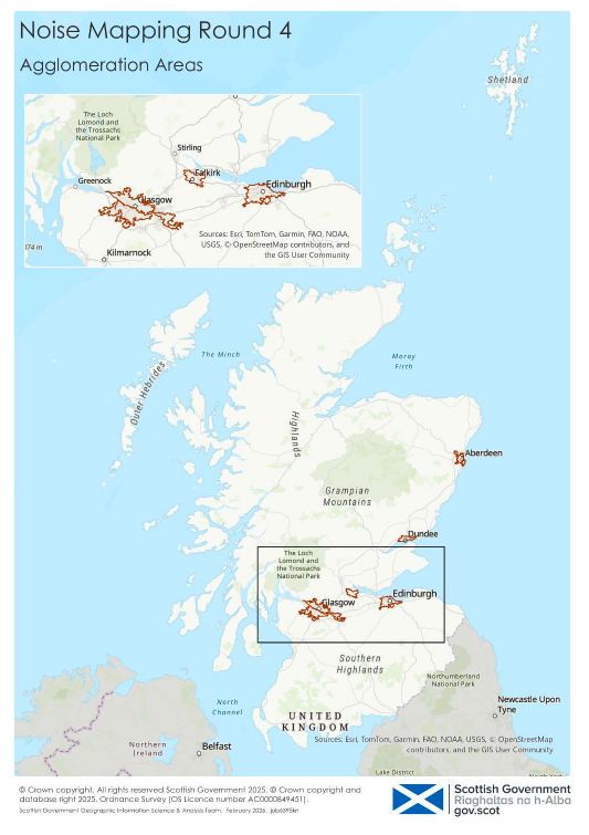
This Agglomerations Noise Action Plan for Scotland covers five agglomerations (Aberdeen, Dundee, Edinburgh, Falkirk, and Glasgow) in Scotland. The Noise Action Plan sets out key objectives to support engagement and development of environmental noise policies.
2. Agglomerations
2.1 A description of each of the five agglomerations
This Agglomerations Noise Action Plan for Scotland covers the five agglomerations in Scotland that meet the 2006 Regulations definition of an agglomeration. These are Aberdeen, Dundee, Edinburgh, Falkirk, and Glasgow. An agglomeration is defined as urbanised areas with a population exceeding 100,000 inhabitants and with a population density equal to or greater than 500 people per km2.
A description for each agglomeration is given below.
2.1.1 Aberdeen
Aberdeen is Scotland’s third-largest city, with a population of approximately 227,000[9] It serves as a major regional centre for the northeast of Scotland, with strong ties to the energy sector, higher education, and maritime industries. The city is home to two universities, a busy seaport, and Aberdeen International Airport, which lies just outside the agglomeration boundary.
The Aberdeen agglomeration spans a mix of urban and suburban areas, bounded by rural Aberdeenshire to the west and north, and the North Sea coastline to the east. The city’s transport infrastructure includes major roads such as the A90, A96, A956, a rail corridor connecting Aberdeen to the central belt and Inverness, and the Aberdeen Western Peripheral Route (AWPR), which has significantly altered traffic patterns and noise distribution since its completion in 2018.
A Low Emission Zone (LEZ) scheme was introduced covering an area within Aberdeen city centre in 2022, with enforcement commencing from 2024, restricting access to the most polluting vehicles. While primarily aimed at improving air quality, the LEZ is expected to contribute to reduced traffic volumes and quieter vehicle types, offering potential secondary benefits for environmental noise reduction.
Aberdeen City Council leads the agglomeration’s noise management efforts, supported by Aberdeenshire Council for areas within the buffer zone. The Aberdeen Local Development Plan 2023 and associated Supplementary Guidance on Noise embed environmental noise considerations into planning decisions, particularly for new housing and infrastructure developments.
Local policies promote active travel, traffic calming, and road resurfacing measures to reduce noise exposure. The city’s strategic place planning service area oversees implementation of noise actions and reports annually on progress.
2.1.2 Dundee
The Dundee Agglomeration is located on the north bank of the River Tay in the Tay Valley on the east coast of Scotland. The agglomeration covers an area of approximately 4,970 hectares (50km2) and comprises a large portion of Dundee City Council (88% of agglomeration area), Perth and Kinross Council within the western part (2% of agglomeration area) and Angus Council in northern and eastern areas (10%).
Dundee is the fourth largest city in Scotland with the most recent estimate of Dundee’s population being 147,720[10] . The approximate total population of the Dundee Agglomeration is 159,380 which takes into account the Dundee (147k), Angus Council (9k) and Perth & Kinross Council (2k) populations within the boundary of the agglomeration.
The Dundee Agglomeration contains a small airport which has regular flights to London Heathrow. There is also a modern deep-water port and large harbour area with aims of creating a major centre for oil and gas decommissioning at the Port of Dundee. A main rail line runs along the southern border of the agglomeration connecting Dundee to Arbroath and Aberdeen to the east, Fife and Edinburgh to the south via the Tay Rail Bridge, and Perth and Glasgow to the west.
The city is a hub for many routes and is connected to Fife by the Tay bridges. The A92 crosses the Tay and emerges in the centre of Dundee. There is an inner ring road, the Marketgait, and five arterial routes - Broughty Ferry Road, Arbroath Road, Riverside Drive, Lochee Road and Forfar Road. There is a by-pass, the Kingsway, which consists of the A90, the main route from Edinburgh/Perth to Aberdeen, and the A92, the route to Arbroath. There are a significant number of busy road junctions across the City. Speed limits vary throughout the agglomeration but are generally 40mph or below, with only small sections of the A90 Kingsway / Forfar Road being 50mph. Many roads in the City have a gradient due to a central topographical feature, an extinct volcano (height being 174m above sea level). 20mph zones have also been rolled out in many areas of Dundee city, while ‘school streets’ have also been introduced where vehicle restrictions are in place around school start and end times during school term times.
Dundee city has a wide diversity of open spaces covering over 1300 hectares. This includes woodlands, beaches, parks, allotment gardens, wildlife sites, burns and ponds. Many are multifunctional and contribute to the quality of life in Dundee by providing opportunities for active and passive recreation, an attractive and sustainable urban environment and a space for nature.
Dundee city is a major employment and retail centre and has a sizeable student population (circa 30,000), being home to the University of Dundee, Abertay University, Dundee & Angus College and Al Maktoum College.
In common with many Scottish cities the architecture consists of a significant number of 4 or 5-storey tenemental properties creating numerous street canyons. In the commercial centres, a common feature of these tenemental properties is that commercial premises are located on the ground floor with residential premises on the floors above. The main shopping area in the city is pedestrianised. Most of the industrial processes are located around the periphery of the city and in the port area. An LEZ scheme was introduced covering an area within the city centre of Dundee in 2022, with enforcement commencing from 2024.
Dundee has gone through major regeneration in recent years, in particular waterfront development. The Dundee Central Waterfront is the focal point of this 30-year project and has involved the creation of a new street layout extending from the city centre down to the waterfront, featuring the iconic Victoria and Albert at Dundee building. The rail station was redeveloped with new civic spaces, Slessor Gardens and the Dundee Waterfront Gardens, created which stretch from the Caird Hall down to the riverside. New hotels, commercial, leisure and residential outlets are required to support the expanding city and new development plots have been created.
Other recent developments include the Michelin Scotland Innovation Parc, and a Life Sciences Innovation District. Plans are also in place to bring the Eden Project to Dundee, with proposals for this to be located on a historical gas works site to the east of the city centre.
2.1.3 Edinburgh
Edinburgh is the capital city of Scotland with a population of approximately 523,000[11]; one of the fastest growing populations of any city in the UK. It is a university city, the locus for much employment in the surrounding region and a tourist centre. In 2023 there were almost 5 million overnight visits to Edinburgh by domestic and international visitors.
The agglomeration area is approximately 261 km2 with approximately 239,000 households. It has an airport which lies just outside the agglomeration boundary, a seaport at Leith, and two major rail stations in the city centre. The city is bounded by Green Belt and the Firth of Forth to the north.
The biggest local authority within the agglomeration study area is the City of Edinburgh Council. A small part of Midlothian Council and a small part of East Lothian Council also fall within the agglomeration study area boundary.
Scottish Transport statistics (2023/24) show that there are approximately 1500km of roads and 400 bridges within the agglomeration. There are 205,000 licensed private and light goods vehicles in the city. The 2022 Census showed that 38% of households had no access to a car, whereas the 2011 Census showed that 42% of households had no access to a car, perhaps indicating a slight trend of increasing car dependency.
The most significant changes to the noise climate in the Edinburgh agglomeration was the development, and subsequent extension, of the Edinburgh tram system, and the adoption of Edinburgh 2030, an ambitious local development plan. New large scale proposed mixed-use developments in the west of the city and along the waterfront will contribute to a planned increase of over 40,000 housing units within the city boundary in the next ten years. Two further two housing developments have been completed at Shawfair and Wallyford which lie just outside the boundary of the agglomeration but within the study area. Also, an LEZ scheme was introduced covering an area within the city centre of Edinburgh in 2022, with enforcement commencing from 2024.
The Edinburgh City Plan 2023 was adopted in November 2024 and replaces the Local Development Plan of 2016. The Edinburgh Agglomeration Noise Action Plan is incorporated into this plan.
Edinburgh 2030 aims to deliver a network of 20-minute neighbourhoods and embed a ‘place-based’ approach to the creation of high quality, high density, mixed use and walkable communities, linked by better active travel and public transport infrastructure. Proposals for major development which would generate significant travel demand will not be supported where there is a reliance on private car use, and there is an emphasis on protecting green spaces.
Noise mapping has also been incorporated into the Planning and Environmental Health Protocol (2017). Many planning applications will present potential environmental issues that require objective assessment and quantification. In some cases, the impacts will be minor and readily amenable to mitigation. Others may be more onerous, requiring more detailed assessment and potentially more complex technical solutions.
2.1.4 Falkirk
The local authority of Falkirk has a population of almost 160,000[12] and covers an area of around 300 km2. Falkirk is the main town and administrative centre of the Falkirk Council area, which also includes the towns of Grangemouth, Bo'ness, Larbert, Stenhousemuir, Denny, and Bonnybridge.
The area is situated right at the centre of Scotland, at the heart of the road and rail network and has an urban core, but it includes rural agricultural areas in the north and south. Although a compact area, it has a diverse landscape character, including the carse land along the Forth Estuary, the river valleys of the Carron, the Avon, and the Bonny Water, and the uplands of the Slamannan Plateau and the Denny Hills to the south and west. The council area borders with North Lanarkshire, Stirling and West Lothian, and, across the Firth of Forth to the northeast, Clackmannanshire and Fife.
Its growing population lives in a network of towns and villages, Falkirk being the principal administrative and service centre, but each community having its own strong identity. The area was one of the cradles of the industrial revolution, and retains a strong manufacturing base, within a diversified economy. Grangemouth hosts the largest chemical and petrochemical complex in Scotland and is also the country’s busiest container port.
Falkirk Council was formed on 1 April 1996 by way of the Local Government etc. (Scotland) Act 1994 from the exact boundaries of Falkirk District, one of three parts of the Central region created in 1975, which was abolished at that time. Prior to the 1975 reorganisation, the majority of the council area was part of the historic county of Stirlingshire, and a small part, namely Bo'ness and Blackness, was part of the former county of West Lothian.
2.1.5 Glasgow
Glasgow is Scotland’s largest city, with a population of 631,970[13]. It serves as a major regional centre and economic powerhouse for the west of Scotland and has seen significant regeneration over the last 30 years successfully shifting from a post-industrial city to a modern learning city rooted in higher education and performing strongly in the retail, financial, major events, sporting and health sectors. Glasgow is a UNESCO City of Music with the hospitality and entertainment sectors underpinning a growing tourism industry.
The Glasgow agglomeration is on the whole urban centre around Glasgow at the heart of the Clyde Valley and supported by a network of suburban areas located in the adjoining authorities of East Dumbartonshire, West Dumbartonshire, North Lanarkshire, Renfrewshire, South Lanarkshire and East Renfrewshire. The agglomeration is focussed on the urban core of the city but reaches all of these surrounding local authority areas.
As Scotland’s only conurbation, the city region’s main transport infrastructure includes major roads such as the M8, M80, M74 and M77 providing direct road connectivity to most of Scotland and rail corridors connecting Edinburgh and the central belt, the north east, west coast and southern Scotland onwards to England. Glasgow has the only subway system in the UK outside London and an extensive network of bus routes. Around 94% of Glasgow's population lives within 300m of an hourly bus service and approximately 50 million rail journeys on the rail network in and around the region. This network includes a suburban commuter rail system with 120km of track and 60 rail stations serving all parts of the city. The city has a strong suburban rail network connecting to the west, parts of the north, the east and south of the agglomeration. The north-east of the city has recently been strengthened in 2019 with the opening of the new Robroyston Park and Ride Station anchoring significant housing led regeneration.
Glasgow's network of green spaces (4,878 ha) accounts for over 27% of the City's total area. The network consists of public parks, amenity open spaces, countryside areas, seven local nature reserves, 46 sites of city-wide importance for nature conservation and around 49 sites of local importance.
The 6,900 individual listed buildings in the city represent the principal elements of Glasgow's architectural heritage. The city also has 22 conservation areas, which extend over 1,476ha, each containing its own distinctive character.
Glasgow's LEZ came into force on 1 June 2023 to tackle stubbornly high levels of harmful air pollution in the city centre. Annual monitoring from 2024 has also shown that for the first time, Glasgow recorded full compliance with all statutory air quality objectives following their introduction thirty years ago. These latest results highlight the effectiveness of Glasgow's LEZ in improving air quality citywide, representing a significant step forward in the city's commitment to reducing pollution and safeguarding public health.
Glasgow City Council leads the agglomeration’s noise management efforts, supported by partner authorities. The Glasgow Agglomeration: Noise Action Plan has been supported from a planning policy perspective since City Plan 2 (adopted 2009) which has been followed through into the current adopted City Development Plan (2017). The emerging City Development Plan 2 will promote a compact city form, focussing regeneration around the benefits of proximity to existing modes of transportation and will seek to re-densify the city centre and local centres in accordance with National Planning Framework 4 (NPF4). NPF4 identifies Clyde Metro – a long-term mass transit system for the Glasgow City Region – which will create a fully integrated public transport network to enhance connectivity and support sustainable growth, economic prosperity and maximise regeneration opportunities.
2.2 Agglomerations Noise Action Plan for Scotland: Actions
This Agglomerations Noise Action Plan sets out key actions for agglomerations to support noise reduction.
Local authorities are already using a variety of measures to support noise reduction, for example, incorporating noise considerations into local action plans and strategies, like City Plans, Local Development Plans. Across local authorities there are a range of policies being implemented that reduce noise from promoting active travel (20-minute neighbourhoods), traffic calming (lowering speed limits to 20mph), introducing LEZs, to road resurfacing measures that will reduce noise exposure.
Table 5 - Agglomerations Noise Action Plan for Scotland Actions
Objective 1: We will improve consideration of environmental noise management in strategic planning
1a. Scottish Government and Agglomeration local authority leads will promote environmental noise management in strategic planning at both National and Local levels
1b. Scottish Government, working closely with local authorities will prepare for the next round of noise mapping, considering data needs and engaging with wider stakeholders.
Objective 2: On a prioritised basis, agglomerations will manage exposure to environmental noise
2a. Agglomeration local authority leads to validate and assess the Candidate Noise Management Areas to identify any Noise Management Areas and prioritise these areas.
2b. For NMAs in agglomerations:
- consider, and where relevant implement, specific measures to support noise management in prioritised Noise Management Areas; and
- apply noise management interventions during existing maintenance and improvement programmes, where practical.
2c. Transport Scotland will work closely with local authorities, to prioritise noise reduction measures for trunk road and rail Noise Management Areas within agglomerations.
Objective 3: We will work with partners to reduce potential exposure to environmental noise and increase awareness of noise control measures and actions
3a. Scottish Government to facilitate the Scottish Environmental Noise Coordination Group, with key partners, to oversee delivery of this noise action plan. The Co-ordinating Group will also:
- engage with local authorities, and other partners, across Scotland on utilising Scotland's noise maps; and
- engage with local authorities across Scotland to support the promotion of case studies of different noise reduction measures that have been used successfully to reduce exposure to environmental noise.
The Scottish Government and the local authorities within the agglomerations have collaborated in producing this agglomerations noise action plan.
2.3 Identification of Noise Management Areas and Quiet Areas
The 2006 Regulations set out that the Noise Action Plans shall meet the objectives of ‘preventing and reducing environmental noise where necessary’, and ‘preserving environmental noise quality where it is good’. Since there are no statutory limit values stated in the 2006 Regulations, this noise action plan sets out the approach used to prioritise the identification of Noise Management Areas and Quiet Areas.
The noise maps are the basis for identifying and focusing on those areas where people are most likely to be annoyed by noise. The noise maps identify the locations of the top 3% population affected by the highest noise levels, these are identified as ‘Important Areas.’ Following further investigation, such areas may be considered Candidate Noise Management Areas (CNMA), prior to formal designation as Noise Management Areas (NMA). These NMAs are largely intended to be the focus of associated noise actions.
To support the identification of noise management areas and quiet areas in agglomerations, this noise action plan sets out:
- CNMA to support management of environmental noise, including noise reduction if necessary; and
- preservation of environmental noise quality where it is good, through Candidate Quiet Areas (CQA).
2.3.1 Noise Management Areas
The first stage in the process of managing environmental noise is to identify CNMA – these are locations exposed to higher levels of environmental noise and the highest number of people exposed. The approach to identifying the CNMA is based on the noise modelling, and while it is not a precise assessment it gives an indication of areas where there are potentially relatively high concentrations of people exposed to higher levels of noise. Local authorities will assess and prioritise the identified CNMA to determine which areas will be designated as Noise Management Areas, and consider the viability of any relevant mitigation measures. Guidance has been issued to the local authorities detailing a potential method to prioritise the CNMAs. This will be used to determine which CNMAs will be addressed within the timeframe of this Noise Action Plan, designating them as Noise Management Areas.
A map of the CNMAs in each agglomeration is at Annex B.
2.3.2 Quiet Areas
The approach to identifying CQAs used available datasets for green spaces. Potential CQA include public parks and gardens with an area greater than 9 hectares and considered to have higher potential for significant community benefit through designation as a Quiet Area. Guidance has been issued to the local authorities detailing a potential method for local checks when considering CQAs.
A list of CQAs for the Agglomerations is at Annex C.
2.4 Long-term strategy
The long-term strategy for noise action planning is to widen engagement across Scotland on noise mapping and continue to improve the source data used in the development of future noise maps.
Broadening stakeholders’ engagement on the noise maps, is a key element of the long-term strategy, as the noise maps now cover the whole of Scotland there is a greater opportunity for them to be used more widely. To support wider engagement the Scottish Government will look for opportunities to engage with local authorities beyond agglomerations aiming to build knowledge and share experiences on noise reduction policies and measures. Recognising the strong synergies between the agglomerations and transport action plans, there will be opportunities to build closer alignment across both action plans, and support stakeholder engagement.
Improving the noise mapping modelling data will enable refinement to the existing model and result in improved accuracy for the model outputs in identifying areas of high noise exposure. More specifically, in preparing for the next round of noise maps (strategic noise maps for Scotland are required to be produced every five years) a key step will be reviewing and identifying the relevant input data sources to support the noise modelling.